
IMAGES TAKEN NEAR TO
Bridgerule, HOLSWORTHY, EX22 7EY
Introduction
This page details the photographs taken nearby to EX22 7EY by members of the Geograph project.
The Geograph project started in 2005 with the aim of publishing, organising and preserving representative images for every square kilometre of Great Britain, Ireland and the Isle of Man.

There are currently over 7.5m images from over14,400 individuals and you can help contribute to the project by visiting https://www.geograph.org.uk
Image Map
Images are licensed for reuse under creativecommons.org/licenses/by-sa/2.0
Notes
- Clicking on the map will re-center to the selected point.
- The higher the marker number, the further away the image location is from the centre of the postcode.
Image Listing (6 Images Found)
Images are licensed for reuse under creativecommons.org/licenses/by-sa/2.0
Image
Details
Distance
1

Lay-by north of Jewell's Cross
The line of trees at the end of the lay-by are the boundary of a small, oddly-shaped field. Old maps show that the lay-by (or equivalent) was there at the end of the 19th century
Image: © David Smith
Taken: 15 Apr 2016
0.09 miles
2

Jewell's Cross
A rural road and petrol station on the boundary of Devon and Cornwall near Bridgerule - one of the few areas where Cornwall is north of Devon
Image: © Pierre Terre
Taken: 30 Jul 2005
0.10 miles
3
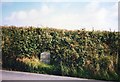
Old Milestone by the B3254, north of Jewell's Cross
Carved stone post by the B3254, in parish of LAUNCELLS (NORTH CORNWALL District), North of Jewells Cross, on fast bend, on East side of road. Kilkhampton County stone, erected by the Local Highways Board in the 19th century.
Inscription reads:-
LAUNCESTON
13
KILKHAMPTON
6
BUDE
(6)
Milestone Society National ID: CW_KHLA06.
Image: © Ian Thompson
Taken: 1 Oct 1995
0.14 miles
4
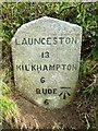
Old Milestone by the B3254, north of Jewell's Cross
Carved stone post by the B3254, in parish of LAUNCELLS (NORTH CORNWALL District), North of Jewell's Cross, on fast bend, on East side of road. Kilkhampton County stone, erected by the Local Highways Board in the 19th century.
Inscription reads:-
LAUNCESTON
13
KILKHAMPTON
6
BUDE
6
Carved benchmark on lower face, right hand side.
Cornwall & Scilly HER.
HER Number: 176718 https://www.heritagegateway.org.uk/Gateway/Results_Single.aspx?uid=MCO52529&resourceID=1020
Milestone Society National ID: CW_KHLA06
Image: © Rosy Hanns
Taken: 21 Apr 2019
0.14 miles
5
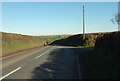
B3254 at Grove
The road passes the right turn to Grove Farm and continues towards Red Post.
Image: © Derek Harper
Taken: 19 Jan 2017
0.24 miles
6

Plant hire depot
At the junction of the B3254 and the roads to Bridgerule and Knowle.
Image: © David Hawgood
Taken: 16 Apr 2007
0.25 miles