IMAGES TAKEN NEAR TO
Sourton, OKEHAMPTON, EX20 4HH
Introduction
This page details the photographs taken nearby to EX20 4HH by members of the Geograph project.
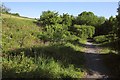
The Geograph project started in 2005 with the aim of publishing, organising and preserving representative images for every square kilometre of Great Britain, Ireland and the Isle of Man.

There are currently over 7.5m images from over14,400 individuals and you can help contribute to the project by visiting https://www.geograph.org.uk
Image Map
Images are licensed for reuse under creativecommons.org/licenses/by-sa/2.0
Notes
- Clicking on the map will re-center to the selected point.
- The higher the marker number, the further away the image location is from the centre of the postcode.
Image Listing (23 Images Found)
Images are licensed for reuse under creativecommons.org/licenses/by-sa/2.0
Image
Details
Distance
1
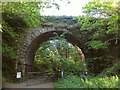
Cuthman's Bridge
Carrying Sourton Bridleway 14 between the A386 and the moor across the Granite Way. The notice on the left explains that the next 230 metres of the track is a right of way only on Bank Holidays and during August, which seems an unusual arrangement. At other time access is permissive. Worse, there is no way up on to the bridleway, so were it to be closed one would have to return to Lake Viaduct and face either a hefty climb up onto the moor, or use the main road. As I'd hurt my knee earlier in the day, and was glad to be within about a kilometre of the end of my walk, neither was an attractive option. Fortunately, the gate was open.
Image: © Derek Harper
Taken: 8 Jun 2013
0.02 miles
2
Sign at Cuthman's Bridge
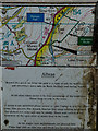
The sign explains the status of the next section of the path and the route that would have to be taken should the gate be locked.
Image: © Guy Wareham
Taken: 28 Apr 2016
0.02 miles
3
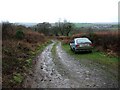
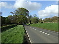
Track to Collaven Manor
Really the track descending from the stroll in Image towards the A386, only 100 metres round the corner. Taken from close to the cottages Woodstock and Albrea.
Image: © Derek Harper
Taken: 20 Jan 2007
0.03 miles
4
Granite Way
Part of the Permissive Path that runs for 230 metres north of Cuthman's Bridge.
Image: © Guy Wareham
Taken: 28 Apr 2016
0.04 miles
5
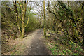
Granite Way in stretch of privately owned land
Most of the Granite Way is on publicly owned land; a short stretch is on private land, where access is a concession
Image: © David Smith
Taken: 2 Sep 2020
0.04 miles
6
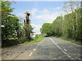
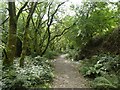
Granite Way near Albrea
The permissive section of the cycle path (former railway) referred to in Image], here approaching the bridge and cutting, but running through a pleasantly open section.
Image: © Derek Harper
Taken: 8 Jun 2013
0.08 miles
7
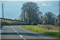
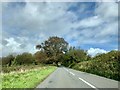
Sourton : The A386
Looking along the A386.
Image: © Lewis Clarke
Taken: 7 Mar 2022
0.09 miles