
IMAGES TAKEN NEAR TO
Crandford Close, OKEHAMPTON, EX20 4HB
Introduction
This page details the photographs taken nearby to Crandford Close, EX20 4HB by members of the Geograph project.
The Geograph project started in 2005 with the aim of publishing, organising and preserving representative images for every square kilometre of Great Britain, Ireland and the Isle of Man.

There are currently over 7.5m images from over14,400 individuals and you can help contribute to the project by visiting https://www.geograph.org.uk
Image Map
Images are licensed for reuse under creativecommons.org/licenses/by-sa/2.0
Notes
- Clicking on the map will re-center to the selected point.
- The higher the marker number, the further away the image location is from the centre of the postcode.
Image Listing (15 Images Found)
Images are licensed for reuse under creativecommons.org/licenses/by-sa/2.0
Image
Details
Distance
1
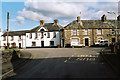
Bridestowe: village street
The Royal Oak is no longer a public house, it seems. The facade carries a sundial with an 18th century date
Image: © Martin Bodman
Taken: 20 Feb 2005
0.05 miles
2
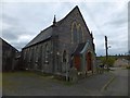
Bridestowe Methodist church
The church was built in 1907; there is a short public footpath on the side, with a fingerpost by the front wall
Image: © David Smith
Taken: 10 Apr 2014
0.05 miles
3
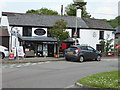
Riverside Stores & Post Office, Bridestowe
Image: © Chris Allen
Taken: 29 May 2016
0.07 miles


8

Dartmoor : Countryside Scenery
Looking out across the countryside.
Image: © Lewis Clarke
Taken: 7 Mar 2022
0.13 miles
9
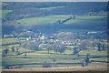
Dartmoor : Bridestowe Scenery
Looking towards the village of Bridestowe.
Image: © Lewis Clarke
Taken: 7 Mar 2022
0.13 miles
