IMAGES TAKEN NEAR TO
Petrockstow, OKEHAMPTON, EX20 3QL
Introduction
This page details the photographs taken nearby to EX20 3QL by members of the Geograph project.
The Geograph project started in 2005 with the aim of publishing, organising and preserving representative images for every square kilometre of Great Britain, Ireland and the Isle of Man.

There are currently over 7.5m images from over14,400 individuals and you can help contribute to the project by visiting https://www.geograph.org.uk
Image Map
Images are licensed for reuse under creativecommons.org/licenses/by-sa/2.0
Notes
- Clicking on the map will re-center to the selected point.
- The higher the marker number, the further away the image location is from the centre of the postcode.
Image Listing (14 Images Found)
Images are licensed for reuse under creativecommons.org/licenses/by-sa/2.0
Image
Details
Distance
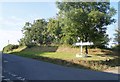
1

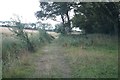
Aish Lodge
Other local placenames are spelt "Ash", but this little lodge, at a junction between the lane from Friar's Hele Cross to Petrockstowe and a farm track on the fringe of Ash Moor, is an exception.
Image: © Derek Harper
Taken: 4 Oct 2007
0.01 miles