
IMAGES TAKEN NEAR TO
Monkokehampton, WINKLEIGH, EX19 8AZ
Introduction
This page details the photographs taken nearby to EX19 8AZ by members of the Geograph project.
The Geograph project started in 2005 with the aim of publishing, organising and preserving representative images for every square kilometre of Great Britain, Ireland and the Isle of Man.

There are currently over 7.5m images from over14,400 individuals and you can help contribute to the project by visiting https://www.geograph.org.uk
Image Map
Images are licensed for reuse under creativecommons.org/licenses/by-sa/2.0
Notes
- Clicking on the map will re-center to the selected point.
- The higher the marker number, the further away the image location is from the centre of the postcode.
Image Listing (12 Images Found)
Images are licensed for reuse under creativecommons.org/licenses/by-sa/2.0
Image
Details
Distance
1
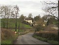
Shilley Bridge
Just north of Monkokehampton, the B3217 crosses Hole Brook and then swings past a cluster of buildings around Hughball Cross.
Image: © Derek Harper
Taken: 20 Feb 2012
0.07 miles
2
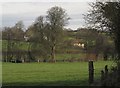
Hole Brook flood plain, Monkokehampton
The Hole Brook flows past the trees across the centre. The thatched Sunnyside Cottage is listed http://www.britishlistedbuildings.co.uk/en-93314-sunnyside-cottage-monkokehampton . View from Monkokehampton Footpath 2.
Image: © Derek Harper
Taken: 20 Feb 2012
0.08 miles
3
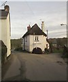
Cottage, Monkokehampton
Occupying the corner between the B3217 (left) and the lane to Broadwoodkelly.
Image: © Derek Harper
Taken: 20 Feb 2012
0.16 miles
4
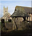
Lych Gate and Church, Monkokehampton
The C19 lych gate is described at http://www.britishlistedbuildings.co.uk/en-93316-lych-gate-approximately-35-metres-to-sout . Monkokehampton Footpath 2 passes through it and across the churchyard. See also Image
Image: © Derek Harper
Taken: 20 Feb 2012
0.17 miles
6
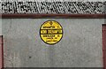
Old circular AA sign on the former B3217 in Monkokehampton
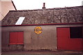
Old AA Sign located on the wall of an old workshop, now a cottage called The Old Forge, on the east side of the former B3217 in Monkokehampton, 8 miles north of Okehampton. Monkokehampton parish.
This is the Circular, village name on black band, no Motor Union symbol or name type, dating from 1923, showing distances Okehampton 7½ Iddesleigh 2¼ London 196. Removed some time between July 2014 and August 2022.
There were five series of AA signs, mostly dating from 1923 and made by Francis & Co / Franco in Deptford, London. The village name and distance to London or Dublin were normally displayed.
See also https://www.flickr.com/photos/livesurfcams/14394800250 , https://www.flickr.com/photos/bumbishop/5656595 and https://www.flickr.com/photos/bridgemarkertim/3966823734.
Milestone Society National ID: DV-MONKO
Image: © A Rosevear
Taken: 24 Jun 2011
0.18 miles
7
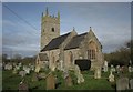
Church of All Saints, Monkokehampton
"Tower early C16, the rest of the church rebuilt in 1855". See http://www.britishlistedbuildings.co.uk/en-93315-church-of-all-saints-monkokehampton for the full description. Monkokehampton Footpath 2 runs through the churchyard.
Image: © Derek Harper
Taken: 20 Feb 2012
0.18 miles
8
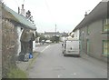
B3217 through Monkokehampton
Near to its junction with Duckport Cross (the road ahead, to the left).
Image: © John Baker
Taken: 26 Mar 2013
0.19 miles
9
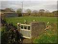
Gate out of churchyard, Monkokehampton
A kissing gate by which Monkokehampton Footpath 2 leaves the churchyard. Image can be seen in the background.
Image: © Derek Harper
Taken: 20 Feb 2012
0.19 miles
10
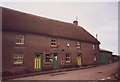
Monkokehampton post office, Devon
This could be Ireland, but is in fact deepest Devon.
Image: © nick macneill
Taken: 26 Mar 1995
0.20 miles