IMAGES TAKEN NEAR TO
Chawleigh, CHULMLEIGH, EX18 7HT
Introduction
This page details the photographs taken nearby to EX18 7HT by members of the Geograph project.
The Geograph project started in 2005 with the aim of publishing, organising and preserving representative images for every square kilometre of Great Britain, Ireland and the Isle of Man.

There are currently over 7.5m images from over14,400 individuals and you can help contribute to the project by visiting https://www.geograph.org.uk
Image Map
Images are licensed for reuse under creativecommons.org/licenses/by-sa/2.0
Notes
- Clicking on the map will re-center to the selected point.
- The higher the marker number, the further away the image location is from the centre of the postcode.
Image Listing (14 Images Found)
Images are licensed for reuse under creativecommons.org/licenses/by-sa/2.0
Image
Details
Distance
2
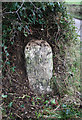
Old Milestone near Duckham, Chawleigh parish
Carved stone post by the UC road, in parish of CHAWLEIGH (MID DEVON District), Duckham Farm, on right side of entrance, under holly in hedge, in bank, on East side of road. Exeter tombstone, erected by the Exeter turnpike trust in the 18th century.
Inscription reads:-
(X)VIII
Miles
From
EXON
Grade II listed.
List Entry Number: 1309420 https://historicengland.org.uk/listing/the-list/list-entry/1309420
Milestone Society National ID: DV_EXLC18
Image: © Alan Rosevear
Taken: 6 Feb 2012
0.08 miles
4
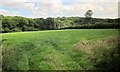
Field near Handsford Farm
This is on the other side of the road from the bridleway shown in http://www.geograph.org.uk/search.php?i=50107958 .
Image: © Derek Harper
Taken: 22 Jul 2014
0.10 miles
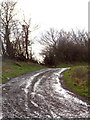
5
Bridleway at Handsford Farm
The bridleway is part of a network of paths which are marked on maps as crossing a roadless area west of the minor road. The farm is a short distance beyond the bridleway sign
Image: © David Smith
Taken: 10 Feb 2014
0.13 miles
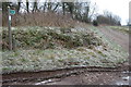
6
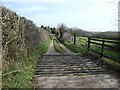
Field access track and bridleway, near Handsford Farm
The bridleway runs round the north of the farm. A hundred years ago, maps show that the right of way ran through the farm buildings.
Image: © David Smith
Taken: 10 Feb 2014
0.14 miles
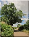
7
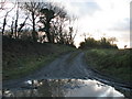
Muddy track north-east of Lapford
Image: © Sarah Charlesworth
Taken: 24 Jan 2010
0.14 miles
8
Bridleway beside Handsford Farm, Chawleigh
Image: © Philip Halling
Taken: 8 Jan 2006
0.15 miles
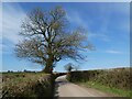
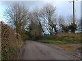
10
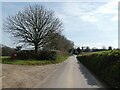
Lane to Labbett's Cross
Occasional trees along the lane from Handsford Farm.
Image: © Derek Harper
Taken: 22 Jul 2014
0.16 miles