
IMAGES TAKEN NEAR TO
HONITON, EX14 9TQ
Introduction
This page details the photographs taken nearby to EX14 9TQ by members of the Geograph project.
The Geograph project started in 2005 with the aim of publishing, organising and preserving representative images for every square kilometre of Great Britain, Ireland and the Isle of Man.

There are currently over 7.5m images from over14,400 individuals and you can help contribute to the project by visiting https://www.geograph.org.uk
Image Map
Images are licensed for reuse under creativecommons.org/licenses/by-sa/2.0
Notes
- Clicking on the map will re-center to the selected point.
- The higher the marker number, the further away the image location is from the centre of the postcode.
Image Listing (27 Images Found)
Images are licensed for reuse under creativecommons.org/licenses/by-sa/2.0
Image
Details
Distance
1
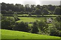
Towards Hale Close Farm
Looking up the greensand scarp slope of Honiton Hill from Honiton Footpath 12. The twin hedges across the image above the farm show the line of the A35.
Image: © Derek Harper
Taken: 28 Aug 2012
0.11 miles
4

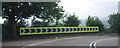
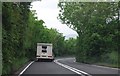
House being repaired on the A35, east of Honiton
Image: © Rob Purvis
Taken: 2 Feb 2023
0.16 miles
5
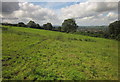
Path to Honiton
The line of Honiton Footpath 12, crossing the broad hillside pasture shown in Image], with part of the town visible below in the Otter valley.
Image: © Derek Harper
Taken: 28 Aug 2012
0.17 miles
6
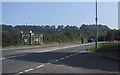
The Old Toll Gates on Axminster Road
Image: © Sarah Charlesworth
Taken: 22 Sep 2008
0.18 miles
7
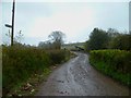
Orange Way in Devon and Torbay (425)
This is going to be a muddy day.
Image: © Shazz
Taken: 18 Apr 2012
0.18 miles
8
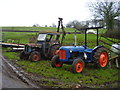
A right pair
Two tractors at Hale Farm.
One has to speculate if they both work.
Image: © Anthony Vosper
Taken: 24 Jan 2016
0.19 miles

10
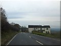
High View on Honiton Hill
The A35 (Axminster Road) descends past this appropriately named house on the slope into Honiton and the Otter valley. On the right is the end of the access road to Hale Farm
Image: © David Smith
Taken: 6 Dec 2012
0.19 miles