IMAGES TAKEN NEAR TO
Stockland, HONITON, EX14 9BX
Introduction
This page details the photographs taken nearby to EX14 9BX by members of the Geograph project.
The Geograph project started in 2005 with the aim of publishing, organising and preserving representative images for every square kilometre of Great Britain, Ireland and the Isle of Man.

There are currently over 7.5m images from over14,400 individuals and you can help contribute to the project by visiting https://www.geograph.org.uk
Image Map
Images are licensed for reuse under creativecommons.org/licenses/by-sa/2.0
Notes
- Clicking on the map will re-center to the selected point.
- The higher the marker number, the further away the image location is from the centre of the postcode.
Image Listing (11 Images Found)
Images are licensed for reuse under creativecommons.org/licenses/by-sa/2.0
Image
Details
Distance
1

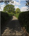
Devon fieldscape
Looking east towards Hornshayes near Stockland.
Image: © M J Richardson
Taken: 11 Jan 2015
0.06 miles
2

Field at Hornshayes Knap Cross
Looking to the left from the stretch of lane shown in Image], with the road to Hornshayes Bridge curving down past trees into the Corry Brook valley.
Image: © Derek Harper
Taken: 25 May 2013
0.16 miles
3

Lane to Hornshayes Bridge
Seen from Hornshayes Knap Cross, shown in Image], with farms across the Corry Brook valley.
Image: © Derek Harper
Taken: 25 May 2013
0.16 miles
4
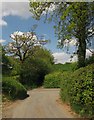
Hornshayes Knap Cross
A crossroads by virtue of the green lane ahead, continuing the line of Groundhead Road northwards. Image was taken looking to the left here. The Buzzard Route, regional cycle route 52, runs along the main lane here, between Hornshayes Bridge and Stockland.
Image: © Derek Harper
Taken: 25 May 2013
0.20 miles
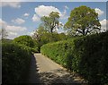
5
Groundhead Lane
View north towards Hornshayes Knap Cross which is just jound the next bend of the road.
Image: © Nigel Mykura
Taken: 7 Aug 2015
0.21 miles
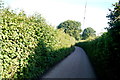
6
Groundhead Road
The lane shown in Image] approaches Hornshayes Knap Cross.
Image: © Derek Harper
Taken: 25 May 2013
0.21 miles
7
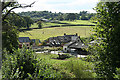
Stockland: Lake Farm
Looking south west with a Langbeer Farm barn on the hill above
Image: © Martin Bodman
Taken: 24 Aug 2006
0.22 miles

9
Groundhead Road
A ridgetop lane linking Rodway Cross to Hornshayes Knap Cross, with some excellent views - see Image, for instance - when the tall hedges allow.
Image: © Derek Harper
Taken: 25 May 2013
0.23 miles
10
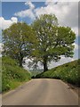
Road to Stockland
From Hornshayes Knap Cross the road, carrying the Buzzard Route (regional cycle route 52), passes between these trees and drops to Stockland.
Image: © Derek Harper
Taken: 25 May 2013
0.24 miles