IMAGES TAKEN NEAR TO
Dalwood, AXMINSTER, EX13 7HS
Introduction
This page details the photographs taken nearby to EX13 7HS by members of the Geograph project.
The Geograph project started in 2005 with the aim of publishing, organising and preserving representative images for every square kilometre of Great Britain, Ireland and the Isle of Man.

There are currently over 7.5m images from over14,400 individuals and you can help contribute to the project by visiting https://www.geograph.org.uk
Image Map
Images are licensed for reuse under creativecommons.org/licenses/by-sa/2.0
Notes
- Clicking on the map will re-center to the selected point.
- The higher the marker number, the further away the image location is from the centre of the postcode.
Image Listing (9 Images Found)
Images are licensed for reuse under creativecommons.org/licenses/by-sa/2.0
Image
Details
Distance
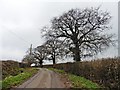
1
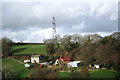
Dalwood: above Hawley Cross
Looking north-north-west to farms or smallholdings
Image: © Martin Bodman
Taken: 26 Nov 2006
0.02 miles
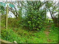
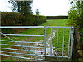
2
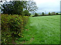
Orange Way in Devon and Torbay (456)
The footpath crosses another field to a gap in the hedge.
Image: © Shazz
Taken: 18 Apr 2012
0.09 miles
3
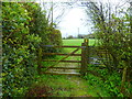
Orange Way in Devon and Torbay (455)
This is the way to go.
Image: © Shazz
Taken: 18 Apr 2012
0.11 miles
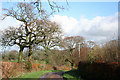
4
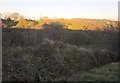
Hawley Bottom
Difficulties with contrast in this winter sunlight view across the narrow valley west of Dalwood. The sun is on a field and trees beside Hawley Farm. The view is from Larkshayes Knap, all in shadow.
Image: © Derek Harper
Taken: 5 Dec 2012
0.17 miles
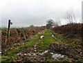
6
Orange Way in Devon and Torbay (454)
The footpath crosses a narrow track to go up steps near buildings at Coombehead Farm.
Image: © Shazz
Taken: 18 Apr 2012
0.19 miles
7
Dalwood: lane to Hawley Cross
Looking north east. Hidden, just beyond the bend, is a bridleway from Larkshayes Farm
Image: © Martin Bodman
Taken: 26 Nov 2006
0.20 miles
9
Orange Way in Devon and Torbay (457)
This looks ahead to a path junction near Hawley Farm buildings.
Image: © Shazz
Taken: 18 Apr 2012
0.22 miles