IMAGES TAKEN NEAR TO
Chardstock, AXMINSTER, EX13 7DD

Introduction

This page details the photographs taken nearby to EX13 7DD by members of the Geograph project.

The Geograph project started in 2005 with the aim of publishing, organising and preserving representative images for every square kilometre of Great Britain, Ireland and the Isle of Man.

There are currently over 7.5m images from over14,400 individuals and you can help contribute to the project by visiting https://www.geograph.org.uk

Image Map


Images are licensed for reuse under creativecommons.org/licenses/by-sa/2.0
Notes
  • Clicking on the map will re-center to the selected point.
  • The higher the marker number, the further away the image location is from the centre of the postcode.

Image Listing (7 Images Found)

Images are licensed for reuse under creativecommons.org/licenses/by-sa/2.0
Image
Details
Distance
1
Stinging nettle at Brockfield
A less than robust specimen of Urtica dioica hangs in the evening sunlight across the lane from Hook to Farway Farm.
Image: © Derek Harper Taken: 22 May 2007
0.01 miles
2
Minor road junction near Brockfield
Image: © Roger Cornfoot Taken: 23 Nov 2016
0.03 miles
3
Ford and footbridge on River Kit
Image: © Roger Cornfoot Taken: 23 Nov 2016
0.10 miles
4
Chardstock Ford
This ford on the River Kit is found at Chardstock. A video of the ford can be seen at: https://youtu.be/F3BzBjZIY20
Image: © John Walton Taken: 5 Jun 2017
0.11 miles
5
Services Building near Hook
This small brick building sits in a well protected compound with a number of other small buildings behind it. It has double barbed wire fences CCTV, guard dog warning signs but no indication of who owns , runs or uses it.
Image: © Nigel Mykura Taken: 12 Mar 2017
0.16 miles
6
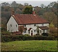
House in Kit valley
Image: © Roger Cornfoot Taken: 23 Nov 2016
0.17 miles
7
River Kit valley
The Kit valley above Farway Marsh, showing the area where it is joined from the left by the stream draining the Hook valley. Seen from a gateway on the lane between Farway Farm and Hook.
Image: © Derek Harper Taken: 22 May 2007
0.23 miles