
IMAGES TAKEN NEAR TO
Charmouth Road, AXMINSTER, EX13 5SZ
Introduction
This page details the photographs taken nearby to Charmouth Road, EX13 5SZ by members of the Geograph project.
The Geograph project started in 2005 with the aim of publishing, organising and preserving representative images for every square kilometre of Great Britain, Ireland and the Isle of Man.

There are currently over 7.5m images from over14,400 individuals and you can help contribute to the project by visiting https://www.geograph.org.uk
Image Map
Images are licensed for reuse under creativecommons.org/licenses/by-sa/2.0
Notes
- Clicking on the map will re-center to the selected point.
- The higher the marker number, the further away the image location is from the centre of the postcode.
Image Listing (13 Images Found)
Images are licensed for reuse under creativecommons.org/licenses/by-sa/2.0
Image
Details
Distance
1

East Devon : The A35 in Fog
The A35 near the Devon Dorset border. The poor conditions continue into the next county.
Image: © Lewis Clarke
Taken: 21 Feb 2011
0.09 miles

3
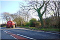
Junction of Harcombe Rd and Charmouth Rd
This slurry tanker or muck spreader being towed by a tractor is just turning off the Charmouth Rd the A35 onto Harcombe Rd.
Image: © Nigel Mykura
Taken: 4 Feb 2015
0.13 miles
4

Raymonds Hill: postbox № EX13 70
An Elizabeth II-reign postbox set into one of the pillars outside the post office, on the A35.
Image: © Chris Downer
Taken: 13 Jun 2009
0.16 miles
5
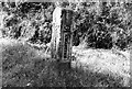
Old Milestone by the A35, Burrowshot Cross, Axminster parish
Axminster pillar iron plate by the A35 (was A373), in parish of Axminster (East Devon District), Burrowshot Cross, Raymonds Hill, road redeveloped.
Lost since 1970.
Inscription reads vertically:-
: AXMINSTER 2 : : BRIDPORT 10 :
Milestone Society National ID: DV_AXBP02
Image: © Milestone Society
Taken: Unknown
0.19 miles
6
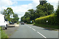
B3165 Crewkerne Road, Raymond's Hill
Towards Crewkerne.
Image: © Robin Webster
Taken: 20 Jul 2019
0.19 miles
7
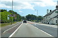
A35, Raymond's Hill
Looking east, with a staggered crossing of the B3165.
Image: © Robin Webster
Taken: 20 Jul 2019
0.21 miles
8
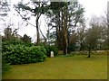
Raymond's Hill Trig Point
Bagged this garden trig point with Alan and Alex after asking permission from the owner.
Image: © Rude Health
Taken: 28 Mar 2015
0.23 miles
9
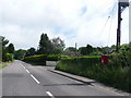
Raymonds Hill: postbox № EX13 133, Crewkerne Road
Looking along the Crewkerne Road – the B3165 – out of Raymonds Hill and heading towards Crewkerne as the road name suggests. The postbox is emptied at 5pm on weekdays and at 10am on Saturdays.
Image: © Chris Downer
Taken: 13 Jun 2009
0.23 miles
10

Hunters Lodge Inn
A travellers inn and restaurant dating back to the 16th C this public house specialising in food is on the very busy A35 at Raymonds Hill just outside Lyme Regis and it benefits from a great deal of passing trade particularly in the holiday periods. The minor road next to the pub is the Lyme Road.
Image: © Nigel Mykura
Taken: 4 Feb 2015
0.23 miles