
IMAGES TAKEN NEAR TO
Musbury Road, AXMINSTER, EX13 5JH
Introduction
This page details the photographs taken nearby to Musbury Road, EX13 5JH by members of the Geograph project.
The Geograph project started in 2005 with the aim of publishing, organising and preserving representative images for every square kilometre of Great Britain, Ireland and the Isle of Man.

There are currently over 7.5m images from over14,400 individuals and you can help contribute to the project by visiting https://www.geograph.org.uk
Image Map
Images are licensed for reuse under creativecommons.org/licenses/by-sa/2.0
Notes
- Clicking on the map will re-center to the selected point.
- The higher the marker number, the further away the image location is from the centre of the postcode.
Image Listing (285 Images Found)
Images are licensed for reuse under creativecommons.org/licenses/by-sa/2.0
Image
Details
Distance
1
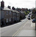
Musbury Road, Axminster
This part of Musbury Road, heading away from the town centre, is unclassified.
Out of shot, at the King Edward Road junction, Musbury Road becomes the A358 Musbury Road.
Image: © Jaggery
Taken: 9 Mar 2017
0.02 miles
2
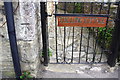
Benchmark on #7 Penny's Terrace, Musbury Road
Ordnance Survey cut mark benchmark described on the Bench Mark Database at http://www.bench-marks.org.uk/bm45532
Image: © Roger Templeman
Taken: 20 Sep 2012
0.06 miles
3
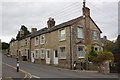
Penny's Terrace, Musbury Road
There is an OS benchmark Image on the front corner of the nearest house by the black downpipe next to its metal side gate
Image: © Roger Templeman
Taken: 20 Sep 2012
0.06 miles
4
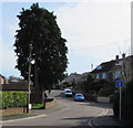
West Close, Axminster
Cul-de-sac on the southeast side of West Street.
Image: © Jaggery
Taken: 9 Mar 2017
0.07 miles
5
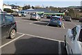
Towards the Co-operative Food store, Axminster
Viewed across a car park on the south side of West Street.
Image: © Jaggery
Taken: 9 Mar 2017
0.08 miles
6
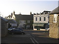
Coombe Street meets South Street
Taken from the car park.
Image: © RNE
Taken: 11 Dec 2005
0.08 miles
7

Benchmark on #15 Hillhead Terrace, Musbury Road
Ordnance Survey cut mark benchmark described on the Bench Mark Database at http://www.bench-marks.org.uk/bm45531
Image: © Roger Templeman
Taken: 20 Sep 2012
0.08 miles
8
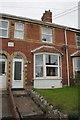
#15 Hillhead Terrace, Musbury Road
There is an OS benchmark Image cut in the bricks to the right of the door
Image: © Roger Templeman
Taken: 20 Sep 2012
0.08 miles
9

Widepost Lane, Axminster
Widepost Lane ascends from the A358 King Edward Road.
Image: © Jaggery
Taken: 9 Mar 2017
0.09 miles
10
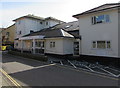
Axminster Medical Practice, Axminster
Located in St Thomas Court, Church Street.
Image: © Jaggery
Taken: 9 Mar 2017
0.11 miles