
IMAGES TAKEN NEAR TO
Long Hill, SEATON, EX12 3HZ
Introduction
This page details the photographs taken nearby to Long Hill, EX12 3HZ by members of the Geograph project.
The Geograph project started in 2005 with the aim of publishing, organising and preserving representative images for every square kilometre of Great Britain, Ireland and the Isle of Man.

There are currently over 7.5m images from over14,400 individuals and you can help contribute to the project by visiting https://www.geograph.org.uk
Image Map
Images are licensed for reuse under creativecommons.org/licenses/by-sa/2.0
Notes
- Clicking on the map will re-center to the selected point.
- The higher the marker number, the further away the image location is from the centre of the postcode.
Image Listing (309 Images Found)
Images are licensed for reuse under creativecommons.org/licenses/by-sa/2.0
Image
Details
Distance
2
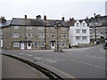
Beer: The Square
The village square, at the top of Fore Street.
Image: © Chris Downer
Taken: 29 Jan 2011
0.02 miles

4
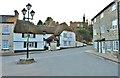
Beer: Junction of Fore Street, Long Hill and Causeway
Image: © Mr Eugene Birchall
Taken: 4 Mar 2010
0.02 miles
5
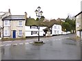
Beer Cross
The junction of Fore Street, Causeway and Long Hill, with Shepherds Cottage in the background.
Image: © Mike Faherty
Taken: 16 Mar 2013
0.02 miles
6

The Square, Beer
Despite the name, this is a triangular junction.
Image: © David Martin
Taken: 21 Jun 2025
0.02 miles
7

Beer Village Stores
By the junction where Causeway becomes Fore Street after passing Long Hill.
Image: © Des Blenkinsopp
Taken: 21 Aug 2025
0.02 miles
9
Terrace at Beer Cross
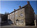
This terrace of three can be seen in several of the images at http://www.geograph.org.uk/gridref/SY2289?centi=SY228894 . "Probably C18 reconstruction of earlier building, with stone tablet on front "1664" " http://list.english-heritage.org.uk/resultsingle.aspx?uid=1333516&searchtype=mapsearch . The dated tablet can be seen between and above the two ground floor windows on the right. The triangular space they dominate is mapped as "The Square" but known as "Beer Cross" on the bus timetables; the X53 has to turn around here to return up The Causeway (left).
The gatepost on the right resembles those on Common Lane, as shown in Image
Image: © Derek Harper
Taken: 27 Oct 2012
0.03 miles
10

Beer, stone cottages
At The Cross; the right-hand cottage has a date stone from 1664. Listed by English Heritage: http://www.imagesofengland.org.uk/Details/Default.aspx?id=87746&mode=adv
Image: © Mike Faherty
Taken: 16 Mar 2013
0.03 miles