Terrace at Beer Cross
Introduction
The photograph on this page of Terrace at Beer Cross by Derek Harper as part of the Geograph project.
The Geograph project started in 2005 with the aim of publishing, organising and preserving representative images for every square kilometre of Great Britain, Ireland and the Isle of Man.

There are currently over 7.5m images from over 14,400 individuals and you can help contribute to the project by visiting https://www.geograph.org.uk
Terrace at Beer Cross
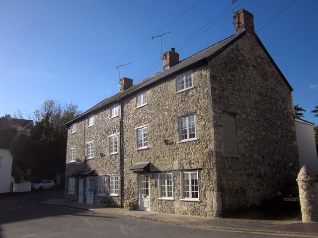
Image: © Derek Harper Taken: 27 Oct 2012
This terrace of three can be seen in several of the images at http://www.geograph.org.uk/gridref/SY2289?centi=SY228894 . "Probably C18 reconstruction of earlier building, with stone tablet on front "1664" " http://list.english-heritage.org.uk/resultsingle.aspx?uid=1333516&searchtype=mapsearch . The dated tablet can be seen between and above the two ground floor windows on the right. The triangular space they dominate is mapped as "The Square" but known as "Beer Cross" on the bus timetables; the X53 has to turn around here to return up The Causeway (left). The gatepost on the right resembles those on Common Lane, as shown in Image
Images are licensed for reuse under creativecommons.org/licenses/by-sa/2.0
Image Location
Latitude
50.699552
Longitude
-3.094067