
IMAGES TAKEN NEAR TO
Harbour Road, SEATON, EX12 2NH
Introduction
This page details the photographs taken nearby to Harbour Road, EX12 2NH by members of the Geograph project.
The Geograph project started in 2005 with the aim of publishing, organising and preserving representative images for every square kilometre of Great Britain, Ireland and the Isle of Man.

There are currently over 7.5m images from over14,400 individuals and you can help contribute to the project by visiting https://www.geograph.org.uk
Image Map
Images are licensed for reuse under creativecommons.org/licenses/by-sa/2.0
Notes
- Clicking on the map will re-center to the selected point.
- The higher the marker number, the further away the image location is from the centre of the postcode.
Image Listing (285 Images Found)
Images are licensed for reuse under creativecommons.org/licenses/by-sa/2.0
Image
Details
Distance
1

Telecoms cabinet near Bradfords Building Supplies, Seaton
Dark green telecoms cabinet viewed across the B3172 Harbour Road.
The shape of the tree, towards the northeast, is an effect
of the prevailing southwest wind in this coastal area.
Image: © Jaggery
Taken: 20 May 2018
0.01 miles
2
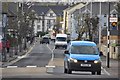
Seaton : Harbour Road B3172
A road passing through Seaton and out towards Axmouth.
Image: © Lewis Clarke
Taken: 21 Dec 2011
0.01 miles
3
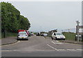
Riverside Way, Seaton
A dead-end road on the north side of Harbour Road, Riverside Way
leads to Riverside Workshops on the west bank of the River Axe.
Image: © Jaggery
Taken: 20 May 2018
0.01 miles
5

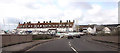
Sea front this way, Seaton
The sign alongside Harbour Road points left towards Trevelyan Road https://www.geograph.org.uk/photo/5781660 which leads to the Esplanade and Seaton Beach. The tiny sign depicting a white acorn on a black background is a direction sign for the South West Coast Path, also reached via Trevelyan Road.
Image: © Jaggery
Taken: 20 May 2018
0.02 miles
6

Pink house, Harbour Road, Seaton
On the north side of the B3172 Harbour Road. Riding the wrong way,
a young child is on a bicycle designed for a younger/smaller child.
Image: © Jaggery
Taken: 20 May 2018
0.02 miles
7
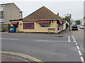
Hong Kong in Seaton
Hong Kong Chinese restaurant on the corner of Harbour Road and Trevelyan Road.
Image: © Jaggery
Taken: 20 May 2018
0.02 miles
8
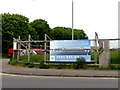
Purl Design Architecture notice, Harbour Road, Seaton
Near the corner of Riverside Way viewed in May 2018. The notice states that Purl Design Architecture are delighted to have achieved planning permission for the Axe Riverside Company Ltd to develop 90 townhouses and apartments. The site is on the west bank of the River Axe in the east of Seaton near Axmouth.
Image: © Jaggery
Taken: 20 May 2018
0.02 miles
9
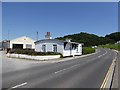
Toll house by Axmouth Bridge
The toll house is listed grade II and has a blue plaque: Axmouth Parish Council Built in 1877 this was the toll house for Axmouth old bridge and is the oldest surviving concrete house in Britain. One penny per person and fourpence per horse and cart was charged until 1907 when the use of the bridge became free. The plaque was provided by Rotary International for its centenary in 2005
Image: © David Smith
Taken: 19 Jul 2016
0.03 miles
10
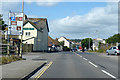
B3172 Harbour Road, Seaton
The entry to the town from the east.
Image: © Robin Webster
Taken: 20 Jul 2019
0.03 miles