
IMAGES TAKEN NEAR TO
Godfrey Close, OTTERY ST. MARY, EX11 1GY
Introduction
This page details the photographs taken nearby to Godfrey Close, EX11 1GY by members of the Geograph project.
The Geograph project started in 2005 with the aim of publishing, organising and preserving representative images for every square kilometre of Great Britain, Ireland and the Isle of Man.

There are currently over 7.5m images from over14,400 individuals and you can help contribute to the project by visiting https://www.geograph.org.uk
Image Map
Images are licensed for reuse under creativecommons.org/licenses/by-sa/2.0
Notes
- Clicking on the map will re-center to the selected point.
- The higher the marker number, the further away the image location is from the centre of the postcode.
Image Listing (44 Images Found)
Images are licensed for reuse under creativecommons.org/licenses/by-sa/2.0
Image
Details
Distance
1
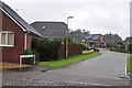
Ottery St Mary : Godfrey Close
A residential road heading off from Thorne Farm Way.
Image: © Lewis Clarke
Taken: 7 Jul 2012
0.02 miles
2
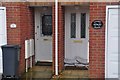
Ottery St Mary : Houses on Thorne Farm Way
Somebody has got extra prepared for the great British summer by putting their sand bags out.
Image: © Lewis Clarke
Taken: 7 Jul 2012
0.05 miles
3

Ottery St Mary : SNG on Thorne Farm Way
A satellite news gathering (SNG) truck on Thorne Farm Way. Rolling 24 hour news were keen to cover the flood at the River Otter.
Image: © Lewis Clarke
Taken: 7 Jul 2012
0.08 miles
4

Ottery St Mary : SNG parked by The River Otter
A satellite news gathering truck parked up beside the flooded River Otter.
Image: © Lewis Clarke
Taken: 7 Jul 2012
0.10 miles
5
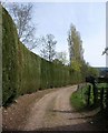
Big hedge near Ottery St Mary
An impressively high hedge preventing anyone from getting a view of Thorne Farm. Seen from Ottery St Mary Footpath 25, which sidles innocuously through the gate on the right.
Image: © Derek Harper
Taken: 6 Apr 2011
0.11 miles
6
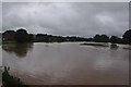
Ottery St Mary : The River Otter
The River Otter which has burst its banks and now spreads to where grassy fields should be.
Image: © Lewis Clarke
Taken: 7 Jul 2012
0.12 miles
7

Ottery St Mary : Footpath & River Otter
A footpath heading alongside the River Otter on a wet Summer afternoon.
Image: © Lewis Clarke
Taken: 7 Jul 2012
0.14 miles
8
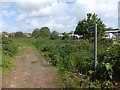
Footpath to a housing estate
A path across an area of grass and scrub, leading into a modern housing estate. The right of way is shown on older maps leading from here to Thorne Farm, on the further side of the houses; the main road through the estate is Thorne Farm Way
Image: © David Smith
Taken: 9 May 2014
0.15 miles
9

Junction with Cadhey Close in Ottery St Mary
The small road that runs from Cadhey Barton south to Ottery St Mary in East Devon. The small turning on the right is into Cadhey Close.
Image: © John P Reeves
Taken: 23 Jul 2025
0.16 miles
10
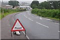
Ottery St Mary : Barrack Road B3147
Barrack Road with a warning of floods as motorists enter Ottery St Mary.
Image: © Lewis Clarke
Taken: 7 Jul 2012
0.16 miles