
IMAGES TAKEN NEAR TO
Tumbling Weir Way, OTTERY ST. MARY, EX11 1GQ
Introduction
This page details the photographs taken nearby to Tumbling Weir Way, EX11 1GQ by members of the Geograph project.
The Geograph project started in 2005 with the aim of publishing, organising and preserving representative images for every square kilometre of Great Britain, Ireland and the Isle of Man.

There are currently over 7.5m images from over14,400 individuals and you can help contribute to the project by visiting https://www.geograph.org.uk
Image Map
Images are licensed for reuse under creativecommons.org/licenses/by-sa/2.0
Notes
- Clicking on the map will re-center to the selected point.
- The higher the marker number, the further away the image location is from the centre of the postcode.
Image Listing (140 Images Found)
Images are licensed for reuse under creativecommons.org/licenses/by-sa/2.0
Image
Details
Distance
1
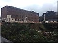
Old Switchgear Factory - Demolition
It's unclear what will happen to the old mill buildings as I believe that they are protected. However, the more modern structure is now in the process of being demolished.
Image: © Glyn Jones
Taken: 17 Jan 2016
0.01 miles
2
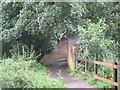
A flooded footpath
The river Otter made this footpath useless after it had burst its banks on Saturday 7th July.
Image: © Emma White
Taken: 7 Jul 2012
0.02 miles
3
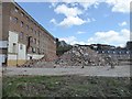
Heaps of spoil, factory demolition, Ottery St Mary
Image: © David Smith
Taken: 23 Apr 2016
0.02 miles
4
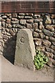
Old Bridge Marker by the B3174, Mill Street
Bridge Marker by the UC road, in parish of Ottery St Mary (East Devon District), South end of Victoria Terrace, 100m N of St Saviour's Bridge, against wall on path/road.
Surveyed
Milestone Society National ID: DV_SDCM06br
Image: © Alan Rosevear
Taken: 25 Mar 2012
0.03 miles
5

Drowning Trees
The floodwater was so high that tree's were disappearing under it
Image: © Emma White
Taken: 7 Jul 2012
0.03 miles
6

Abandoned factory, Ottery St Mary
The tall building in the background was originally a Georgian woollen mill.
Image: © Roger Cornfoot
Taken: 2 Oct 2008
0.03 miles
7
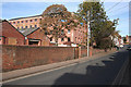
Ottery St Mary: factory
The water-powered woollen mill dating from 1788, later a silk factory, and more recently the home of ‘Otter Mill Switchgear’. With Mill Street on the right and 20th century factory units in the foreground, left
Image: © Martin Bodman
Taken: 12 Nov 2007
0.04 miles
8

Ottery St Mary : Closed Public Footpath
The Fire & Rescue Service have closed this footpath heading up to Mill Leat due to flooding.
Image: © Lewis Clarke
Taken: 7 Jul 2012
0.04 miles
9

Inscription on iron bridge over River Otter
Image: © David Smith
Taken: 18 Apr 2011
0.04 miles
10
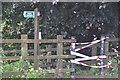
Ottery St Mary : Closed Public Footpath
The fire service have shut off this footpath with some tape due to flooding.
Image: © Lewis Clarke
Taken: 7 Jul 2012
0.04 miles