
IMAGES TAKEN NEAR TO
Greenhead, SIDMOUTH, EX10 0QD
Introduction
This page details the photographs taken nearby to Greenhead, EX10 0QD by members of the Geograph project.
The Geograph project started in 2005 with the aim of publishing, organising and preserving representative images for every square kilometre of Great Britain, Ireland and the Isle of Man.

There are currently over 7.5m images from over14,400 individuals and you can help contribute to the project by visiting https://www.geograph.org.uk
Image Map
Images are licensed for reuse under creativecommons.org/licenses/by-sa/2.0
Notes
- Clicking on the map will re-center to the selected point.
- The higher the marker number, the further away the image location is from the centre of the postcode.
Image Listing (11 Images Found)
Images are licensed for reuse under creativecommons.org/licenses/by-sa/2.0
Image
Details
Distance
1
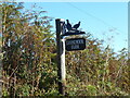
Signpost for Goosemoor farm
A pedantic observation. Those are pheasants.
Of which there are plenty in the surrounding fields.
Image: © Anthony Vosper
Taken: 13 Oct 2022
0.01 miles
2

Trees near Sidbury
The trees are along the stream crossed in Image This view is from the East Devon Way following Sidmouth Footpath 57 across a narrow meadow.
Image: © Derek Harper
Taken: 21 Oct 2011
0.12 miles
3

East Devon Way below Goosemoor Farm
At the foot of the hill shown in Image, with the farm lane carrying the Way (and Sidmouth Footpath 56) across a stream and starting a climb on the other side. Where the lane disappears from view, the Way turns off into a field on the left.
Image: © Derek Harper
Taken: 21 Oct 2011
0.13 miles
4

Autumn colours
Small lanes and tracks take on Autumn hues.
Image: © Anthony Vosper
Taken: 31 Oct 2017
0.13 miles
5

Fields and trees near Sidbury
Another view from the same field as Image, across the wooded stream, this time looking further west. The trees beyond the cattle are along a lane to Home Farm.
Image: © Derek Harper
Taken: 21 Oct 2011
0.16 miles
6

Sidbury: Manor Mill Leat
The water-powered Manor Mill has been restored and is open to the public
Image: © Martin Bodman
Taken: 3 Sep 2004
0.17 miles
7

East Devon Way approaching Sidbury
The Way follows Sidmouth Footpath 57 around the edge of this field west of the village. On the upper slopes across the Sid valley is Buckley Plantation.
Image: © Derek Harper
Taken: 21 Oct 2011
0.18 miles
8
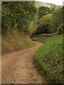
East Devon Way by Goosemoor Farm
The farm lane curves down between banks into the valley bottom. The Way is following Sidmouth Footpath 56.
Image: © Derek Harper
Taken: 21 Oct 2011
0.18 miles
10

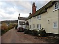
Goosemoor Farm
"Probably C17 or C18" according to http://www.britishlistedbuildings.co.uk/en-87371-goosemoor-farmhouse-sidmouth .
Image: © Derek Harper
Taken: 21 Oct 2011
0.23 miles