IMAGES TAKEN NEAR TO
Borough Way, POTTERS BAR, EN6 3HA
Introduction
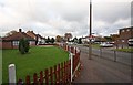
This page details the photographs taken nearby to Borough Way, EN6 3HA by members of the Geograph project.
The Geograph project started in 2005 with the aim of publishing, organising and preserving representative images for every square kilometre of Great Britain, Ireland and the Isle of Man.

There are currently over 7.5m images from over14,400 individuals and you can help contribute to the project by visiting https://www.geograph.org.uk
Image Map
Images are licensed for reuse under creativecommons.org/licenses/by-sa/2.0
Notes
- Clicking on the map will re-center to the selected point.
- The higher the marker number, the further away the image location is from the centre of the postcode.
Image Listing (55 Images Found)
Images are licensed for reuse under creativecommons.org/licenses/by-sa/2.0
Image
Details
Distance
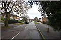
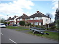
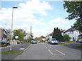
2
Auckland Road at the junction of Mimms Hall Road
Image: © David Howard
Taken: 5 Jun 2014
0.14 miles
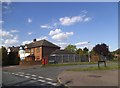
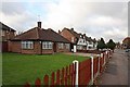
3
Bungalows on Dugdale Hill Lane, Potters Bar
Image: © JThomas
Taken: 15 Apr 2017
0.14 miles
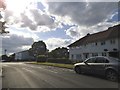
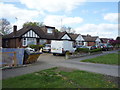
10
Dugdale Hill Lane, Potters Bar
Looking north east.
Image: © JThomas
Taken: 15 Apr 2017
0.20 miles