
IMAGES TAKEN NEAR TO
Lytton Road, BARNET, EN5 5BU
Introduction
This page details the photographs taken nearby to Lytton Road, EN5 5BU by members of the Geograph project.
The Geograph project started in 2005 with the aim of publishing, organising and preserving representative images for every square kilometre of Great Britain, Ireland and the Isle of Man.

There are currently over 7.5m images from over14,400 individuals and you can help contribute to the project by visiting https://www.geograph.org.uk
Image Map
Images are licensed for reuse under creativecommons.org/licenses/by-sa/2.0
Notes
- Clicking on the map will re-center to the selected point.
- The higher the marker number, the further away the image location is from the centre of the postcode.
Image Listing (87 Images Found)
Images are licensed for reuse under creativecommons.org/licenses/by-sa/2.0
Image
Details
Distance
1
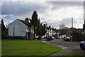
Shaftesbury Avenue
Looking from the green beside Cromer Road.
Image: © Martin Addison
Taken: 21 Nov 2008
0.07 miles
2
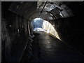
Subway under the East Coast main railway line, New Barnet
This pedestrian subway passes under the main East Coast railway line close to New Barnet station. It connects the Victoria Recreation Ground with Cromer Road.
Image: © Paul Bryan
Taken: 8 Mar 2014
0.07 miles
3
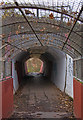
Footpath to Cromer Road
Looking through the tunnel under the Mainline from Kings Cross, from the footbridge across the Gas Alliance compound.
Image: © Martin Addison
Taken: 21 Nov 2008
0.09 miles
4
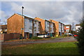
Cromer Road
Some of the housing on this mini-estate next to the Kings Cross mainline.
Image: © Martin Addison
Taken: 21 Nov 2008
0.09 miles
5
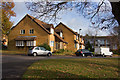
Cromer Road
Housing on the extension of this road into a mini-estate. seen from the junction with Boleyn Way.
Image: © Martin Addison
Taken: 21 Nov 2008
0.10 miles
6
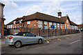
Cromer Road Primary School
The Hertfordshire coat of arms adorns the centre of the facade.
Image: © Martin Addison
Taken: 21 Nov 2008
0.11 miles
7
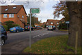
Boleyn Way
Looking into this housing estate on the end of Cromer Road. Cromer Road itself has been extended on the right to form a mini-estate. The sign indicates the footpath to Victoria Recreation Ground.
Image: © Martin Addison
Taken: 21 Nov 2008
0.12 miles
8
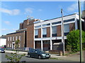
Barnet Telephone Exchange (2)
Taken in Leicester Road, New Barnet, this photo shows the TE extension on the right of the photo whilst the original building is to its left. This TE now has 0208-440, 441 and 449 xxxx numbers, plus some Outer London numbers. Mobile phone aerials can be seen on the roof of this latter building.
Image: © David Hillas
Taken: 8 Jun 2013
0.12 miles
9
Barnet Telephone Exchange (1)
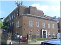
Located at 5 Leicester Road, New Barnet EN5 5EP, this TE dates from the late 1940s and used to have BARnet and HADley Wood numbers until the late 1960s. Besides Barnet and Hadley Wood, this TE also serves Arkley and Cockfosters nearby. The vehicle entrance with the blue IN signs and 5mph sign can be seen to the left of the photo, whilst mobile phone aerials can be seen of the roof of this large building.
Image: © David Hillas
Taken: 8 Jun 2013
0.12 miles
10
Lytton Road
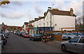
Lots of small business premises and take away's along this street backing onto the Kings Cross mainline.
Image: © Martin Addison
Taken: 21 Nov 2008
0.13 miles