
IMAGES TAKEN NEAR TO
Byng Road, BARNET, EN5 4NP
Introduction
This page details the photographs taken nearby to Byng Road, EN5 4NP by members of the Geograph project.
The Geograph project started in 2005 with the aim of publishing, organising and preserving representative images for every square kilometre of Great Britain, Ireland and the Isle of Man.

There are currently over 7.5m images from over14,400 individuals and you can help contribute to the project by visiting https://www.geograph.org.uk
Image Map
Images are licensed for reuse under creativecommons.org/licenses/by-sa/2.0
Notes
- Clicking on the map will re-center to the selected point.
- The higher the marker number, the further away the image location is from the centre of the postcode.
Image Listing (43 Images Found)
Images are licensed for reuse under creativecommons.org/licenses/by-sa/2.0
Image
Details
Distance

2
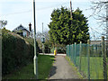
Footpath from Calvert Road to Byng Road
A sign on the post ahead indicates it is also the footway to the primary school whose premises are on the right.
Image: © Robin Webster
Taken: 14 Apr 2013
0.05 miles
3
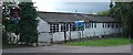
Curriculum Centre and Barnet Nature Centre, Byng Road, Barnet
One of a small collection of old (1930s?) school buildings pressed into use as a Nature Centre and a "Curriculum Centre". Situated adjacent to the Denis Bland Nature Reserve.
Image: © Pete Chapman
Taken: 18 Aug 2005
0.05 miles
4
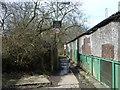
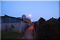
Footpath from Byng Road to Cavendish Road
It improves and widens once past the scruffy building on the right.
Image: © Robin Webster
Taken: 14 Apr 2013
0.06 miles

8
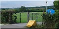
School Playing Field, Byng Road, High Barnet
A playing field sandwiched between agricultural fields and suburban housing on the extreme northern edge of the London conurbation at High Barnet.
Image: © Pete Chapman
Taken: 18 Aug 2005
0.08 miles
9
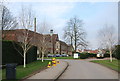
Queen Elizabeth I School, Barnet
A Boys' Independent School. The School was founded in 1573, following a request of a charter for the School by Robert Dudley, Earl of Leicester. Queen Elizabeth I granted the charter, for "...the establishment of the Free Grammar School of Queen Elizabeth in Barnet, for the education, bringing up and instruction of boys”.
Website: http://www.qebarnet.co.uk/
Image: © N Chadwick
Taken: 20 Mar 2011
0.08 miles
10
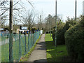
Footpath behind Wentworth Road
This is probably most heavily used at each end of the school day - there is an infants school on the left.
Image: © Robin Webster
Taken: 14 Apr 2013
0.09 miles