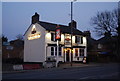
IMAGES TAKEN NEAR TO
St. Albans Road, BARNET, EN5 4LN
Introduction
This page details the photographs taken nearby to St. Albans Road, EN5 4LN by members of the Geograph project.
The Geograph project started in 2005 with the aim of publishing, organising and preserving representative images for every square kilometre of Great Britain, Ireland and the Isle of Man.

There are currently over 7.5m images from over14,400 individuals and you can help contribute to the project by visiting https://www.geograph.org.uk
Image Map
Images are licensed for reuse under creativecommons.org/licenses/by-sa/2.0
Notes
- Clicking on the map will re-center to the selected point.
- The higher the marker number, the further away the image location is from the centre of the postcode.
Image Listing (156 Images Found)
Images are licensed for reuse under creativecommons.org/licenses/by-sa/2.0
Image
Details
Distance
1
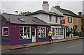
Shops and Cottages on St. Albans Road
A police officer walks past the garishly coloured Mirror Mad shop on his way to take up traffic control duties outside the Territorial Army base. He and other officers will prevent access to Barnet High Street and St. Albans Road while the Remembrance Day parade passes through.
Image: © Martin Addison
Taken: 8 Nov 2009
0.03 miles
2
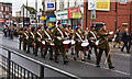
Remembrance Day Parade, Barnet
The band, marching in the centre of the parade so that both ends of the column can hear the beat and keep in step, makes its way along St. Albans Road towards the Territorial Army barracks.
Image: © Martin Addison
Taken: 8 Nov 2009
0.06 miles
3
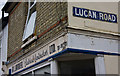
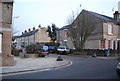
Corner Shop, Alston Road
Detail of a one-time corner shop, now an electrical contractors office, at the junction with Lucan Road. The paint is peeling and the telephone number is out of date, so I wonder if it is still in use.
Image: © Martin Addison
Taken: 8 Nov 2009
0.06 miles
5
Waiting For The Driver
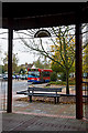
A 234 bus stands at the terminus of the route on Staplyton Road behind The Spires shopping centre. The structure in the foreground seems to be a bandstand, though how much use it sees I don't know. The road between the two is a service road beside Barnet Market.
Image: © Martin Addison
Taken: 8 Nov 2009
0.07 miles
6

The White Lion
A small Fullers public house located on St.Albans Road (A1081). I think the council could have put more thought into placing the lamp post;-)
Image: © Martin Addison
Taken: 28 Sep 2012
0.07 miles
7
Hadley Green Garage
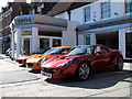
The lotus Showroom with a very nice line up of cars outside.
Image: © Martin Addison
Taken: 16 Mar 2007
0.07 miles
8
St Albans or Potters Bar?
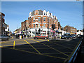
Junction at the north end of Barnet High Street. On the right, the A1000, High Street, continues north to Potters Bar. On the left is the A1081, St.Albans Road. The shops in the v of the junction carry a date of 1891.
Image: © Martin Addison
Taken: 16 Mar 2007
0.08 miles
9
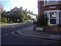
Corner of Falkland Road and Alston Road
Image: © David Howard
Taken: 25 Oct 2011
0.08 miles