IMAGES TAKEN NEAR TO
Sebright Road, BARNET, EN5 4HR
Introduction
This page details the photographs taken nearby to Sebright Road, EN5 4HR by members of the Geograph project.
The Geograph project started in 2005 with the aim of publishing, organising and preserving representative images for every square kilometre of Great Britain, Ireland and the Isle of Man.

There are currently over 7.5m images from over14,400 individuals and you can help contribute to the project by visiting https://www.geograph.org.uk
Image Map
Images are licensed for reuse under creativecommons.org/licenses/by-sa/2.0
Notes
- Clicking on the map will re-center to the selected point.
- The higher the marker number, the further away the image location is from the centre of the postcode.
Image Listing (93 Images Found)
Images are licensed for reuse under creativecommons.org/licenses/by-sa/2.0
Image
Details
Distance
1
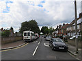
Wentworth Road
To the left is Byng Road
Image: © Andrew Tatlow
Taken: 3 Jul 2016
0.06 miles
2
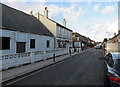
Alston Road and Sebright Arms
In the centre is the Sebright Arms which is to be recommended. It is not one big noisy room and has excellent beer and excellent pub food!
Image: © Andrew Tatlow
Taken: 2 Mar 2016
0.06 miles
4
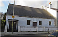
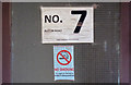
No 7 Alston Road
This is a former meeting hall or church of the Assemblies of God in Great Britain which is one of the largest Pentecostal Christian denominations. According to the estate agent details the main hall included a baptism pool. A planning application was made to the London Borough of Barnet in July 2015 reference 15/04271/FUL which proposed "Demolition of existing building (Class D1) and erection of two-storey building with rooms in roof space to create 4 new self-contained units." One of the attachments to the planning application would indicate that the membership dwindled from about 10 to 2 over recent years.
Image: © Andrew Tatlow
Taken: 2 Mar 2016
0.06 miles
5
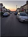
The last road before the greenbelt
Looking north-west down Sebright Road on a peaceful summer evening. Cars parked bumper to bumper half on the pavements. The Greenbelt starts at the bottom of the road. Then there are two miles of fields, the M25, and the built-up area starts again.
Image: © Bikeboy
Taken: 6 Aug 2022
0.06 miles

7
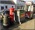
Street furniture outside Jerome News
The postbox is number EN5 12.
Image: © Andrew Tatlow
Taken: 2 Mar 2016
0.07 miles
8
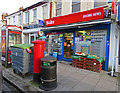
Jerome News
This is probably a former post office as it has both post box and telephone box outside. The postbox is number EN5 12.
Image: © Andrew Tatlow
Taken: 2 Mar 2016
0.07 miles