
IMAGES TAKEN NEAR TO
The Avenue, BARNET, EN5 4EW
Introduction
This page details the photographs taken nearby to The Avenue, EN5 4EW by members of the Geograph project.
The Geograph project started in 2005 with the aim of publishing, organising and preserving representative images for every square kilometre of Great Britain, Ireland and the Isle of Man.

There are currently over 7.5m images from over14,400 individuals and you can help contribute to the project by visiting https://www.geograph.org.uk
Image Map
Images are licensed for reuse under creativecommons.org/licenses/by-sa/2.0
Notes
- Clicking on the map will re-center to the selected point.
- The higher the marker number, the further away the image location is from the centre of the postcode.
Image Listing (110 Images Found)
Images are licensed for reuse under creativecommons.org/licenses/by-sa/2.0
Image
Details
Distance
1
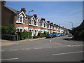
Barnet: The Drive
Viewed looking from The Avenue.
Image: © Nigel Cox
Taken: 12 Jul 2006
0.02 miles
2
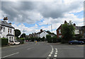
The Avenue
Immediately to the right is Wentworth Road and the more distant right turn is Marriott Road.
Image: © Andrew Tatlow
Taken: 3 Jul 2016
0.06 miles
3
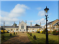
Leather Sellers Almshouses
"These almshouses were built by The Leathersellers Company, one of the ancient Livery (uniform making) Companies of the City of London. Livery Companies have a tradition of providing accommodation for the elderly. The foundation stone for these almshouses was laid in July 1837, with further wings added in 1849 and 1866. They were originally intended for poor members of the Company or their widows. Each almsman (person) received a weekly pension and a coal allowance."
Info from Historic England. https://historicengland.org.uk/services-skills/education/educational-images/the-leather-sellers-almshouses-union-street-barnet-199142
Image: © Des Blenkinsopp
Taken: 20 Apr 2017
0.07 miles
4
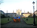
Barnet: The Leather Sellers' Almshouses
These almshouses date from the early 19th century and feature a chapel in the middle of the block. The building is Grade II Listed. This is the view through The Avenue gates. Apologies for the skip.
Image: © Nigel Cox
Taken: 7 Mar 2015
0.07 miles
5
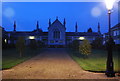
Leather Selers Almshouses and Church
Grade II listed. http://www.britishlistedbuildings.co.uk/en-199142-the-leather-sellers-almshouses-barnet
Image: © N Chadwick
Taken: 20 Mar 2011
0.08 miles
6
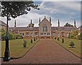
Leathersellers' Close, High Barnet
For an extensive description and history of these almshouses see this http://www.londongardensonline.org.uk/gardens-online-record.asp?ID=BAR039a.
Image: © Jim Osley
Taken: 18 Jul 2015
0.08 miles
7
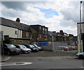
Entrance to T & H Motors Ltd
The company website (http://tandhmotorsgaragebarnet.co.uk/) says "We have over 90 years' experience in the motor industry and offer a full diagnostic service. We are Rolls-Royce and Bentley specialists but we can service and repair all makes and models of cars, including kit cars, high performance cars, classic cars and rare cars."
Image: © Andrew Tatlow
Taken: 3 Jul 2016
0.09 miles
8
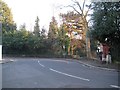
Barnet: Ravenscroft Park Boundary Stone
On the right the brick pier marks the entrance to Ravenscroft Park, while the white Portland Stone in front is an old boundary stone, now a Grade II Listed Structure. The carved inscription is now so worn that the photographer is indebted to the English Heritage website for providing this transcription:-
""This stone stands on the pre-historic landmark Grimsdyke, which forms part of the boundary of the Parish of Chipping Barnet"
and
"This stone was originally a boundary stone of the Whetstone and Highgate Turnpike trust which built Barnet Hill about 1823"."
Image: © Nigel Cox
Taken: 7 Mar 2015
0.09 miles
10

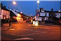
Wentworth Road from Byng Road junction
The junction with Alston Road and The Avenue is in the distance in the next square. Byng Road is immediately to the right. Note the Byng Road sign to the right; completely different to the one on the other side! See Image
Image: © Andrew Tatlow
Taken: 3 Jul 2016
0.09 miles