IMAGES TAKEN NEAR TO
Pellow Close, BARNET, EN5 2UP
Introduction
This page details the photographs taken nearby to Pellow Close, EN5 2UP by members of the Geograph project.
The Geograph project started in 2005 with the aim of publishing, organising and preserving representative images for every square kilometre of Great Britain, Ireland and the Isle of Man.

There are currently over 7.5m images from over14,400 individuals and you can help contribute to the project by visiting https://www.geograph.org.uk
Image Map
Images are licensed for reuse under creativecommons.org/licenses/by-sa/2.0
Notes
- Clicking on the map will re-center to the selected point.
- The higher the marker number, the further away the image location is from the centre of the postcode.
Image Listing (40 Images Found)
Images are licensed for reuse under creativecommons.org/licenses/by-sa/2.0
Image
Details
Distance
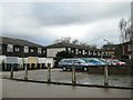
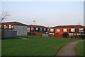
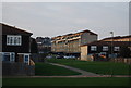
2
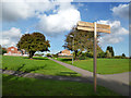
More Houses
New housing development underway on what were, I believe, allotments. View taken from the Dollis Valley Green Walk looking towards Dollis Valley Way housing estate.
Image: © Martin Addison
Taken: 1 Apr 2007
0.06 miles
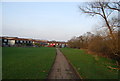
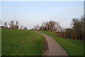
8
Loop & Greenwalk
The London Loop LDP and Dollis Valley Greenwalk share route and signage along this section.
Image: © Des Blenkinsopp
Taken: 24 Oct 2013
0.13 miles
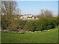
10
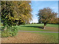
On the Dollis Valley Greenwalk
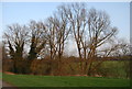
The Dollis Valley Greenwalk is about ten miles long and runs from Hampstead Heath to join the Dollis Brook near the North Circular Road and then follows the Brook to beyond its source at Moat Mount.
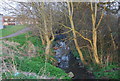
The Dollis Brook rises at Moat Mount near Arkley, firstly flowing eastwards through the open countryside of Totteridge Fields to Chipping Barnet and then through the suburbs of Barnet to Hendon. Its route can be traced by the thin strip of woodland along the riverbank and ribbon of open land on either side which provides a valuable green corridor. At Hendon the Dollis Brook meets the Mutton Brook and becomes the River Brent which then flows into the Welsh Harp Reservoir and subsequently the River Thames at Brentford.
Here the London LOOP also follows the Dollis Valley Greenwalk. The Dollis Brook is to the right in the trees.
Image: © Marathon
Taken: 2 Nov 2016
0.14 miles