
IMAGES TAKEN NEAR TO
Bells Hill, BARNET, EN5 2SG
Introduction
This page details the photographs taken nearby to Bells Hill, EN5 2SG by members of the Geograph project.
The Geograph project started in 2005 with the aim of publishing, organising and preserving representative images for every square kilometre of Great Britain, Ireland and the Isle of Man.

There are currently over 7.5m images from over14,400 individuals and you can help contribute to the project by visiting https://www.geograph.org.uk
Image Map
Images are licensed for reuse under creativecommons.org/licenses/by-sa/2.0
Notes
- Clicking on the map will re-center to the selected point.
- The higher the marker number, the further away the image location is from the centre of the postcode.
Image Listing (51 Images Found)
Images are licensed for reuse under creativecommons.org/licenses/by-sa/2.0
Image
Details
Distance
2
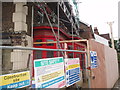
Last Orders at the Alexandria Pub
The pub closed down and it looks like it being converted into residential use.
Image: © Bikeboy
Taken: 4 Jun 2012
0.13 miles
3
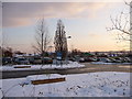
Car Park, Barnet Hospital, Wellhouse Lane, Barnet
Looking across the car park at Barnet Hospital.
Image: © Christine Matthews
Taken: 8 Jan 2010
0.13 miles
4
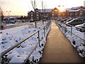
Entrance to Barnet Hospital, Wellhouse Lane, Barnet
Looking down the main pathway towards the entrance to Barnet Hospital.
Image: © Christine Matthews
Taken: 8 Jan 2010
0.14 miles
5
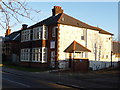
Wellhouse Lane, Barnet
House at top of Wellhouse Lane.
Image: © Christine Matthews
Taken: 2 Jan 2010
0.14 miles
6
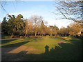
Barnet: Ravenscroft Gardens
This land once formed part of Barnet Common, which was partly enclosed in 1729 and fully in 1815. In the 1880s, when a new road, Ravenscroft Park, and new housing were being built here, a small area of the remaining open land, between Ravenscroft Park and Wood Street, with a pond was converted into this public park. It was originally called Barnet Recreation Ground, but it was later named after James Ravenscroft, a leading benefactor of Barnet. Serpentine walks formed part of the original layout. There used to be two ornamental ponds in the park, one in the corner shown in this view, but these were drained in 1992. Some current versions of the Ordnance Survey mapping still show the location of this pond.
Image: © Nigel Cox
Taken: 7 Mar 2015
0.15 miles
7
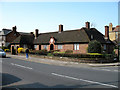
Eleanor Palmer Charity Almshouses
Another group of Almshouses on Wood Street, Barnet. The Eleanor Palmer Charity was set up when she died in 1585 leaving two acres of land in Kentish Town for the use of the poor. The gift allowed these almshouses to be built on, what was then, Barnet Common in 1820. They were rebuilt in 1930 with a further two houses being added to the original Six.
Image: © Martin Addison
Taken: 1 Apr 2007
0.15 miles
8
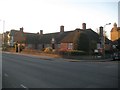
Barnet: Eleanor Palmer Trust Almshouses
Please see Martin's Image for a description and a view from a virtually identical location, on the A411 Wood Street. The Trust's website is here http://www.eleanorpalmertrust.org.uk/history.html
Image: © Nigel Cox
Taken: 7 Mar 2015
0.15 miles
9
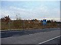
Land adjacent to Barnet Hospital, Wellhouse Lane
Looking north east from the entrance to Barnet Hospital.
Image: © Christine Matthews
Taken: 15 Dec 2009
0.16 miles
10
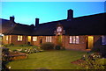
Eleanor Palmer Trust Almshouses, Barnet
Image: © N Chadwick
Taken: 20 Mar 2011
0.16 miles