IMAGES TAKEN NEAR TO
Sellwood Drive, BARNET, EN5 2RW
Introduction
This page details the photographs taken nearby to Sellwood Drive, EN5 2RW by members of the Geograph project.
The Geograph project started in 2005 with the aim of publishing, organising and preserving representative images for every square kilometre of Great Britain, Ireland and the Isle of Man.

There are currently over 7.5m images from over14,400 individuals and you can help contribute to the project by visiting https://www.geograph.org.uk
Image Map
Images are licensed for reuse under creativecommons.org/licenses/by-sa/2.0
Notes
- Clicking on the map will re-center to the selected point.
- The higher the marker number, the further away the image location is from the centre of the postcode.
Image Listing (19 Images Found)
Images are licensed for reuse under creativecommons.org/licenses/by-sa/2.0
Image
Details
Distance
3
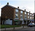
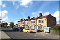
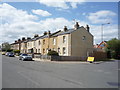
Shops on Bells Hill
Typical 1960s style row of shops with houses on top.
Image: © Andrew Tatlow
Taken: 11 Feb 2016
0.14 miles
4
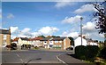
Almost a Cross Roads
Connaught Road and Chesterfield Road meet Mays Lane.
Image: © Des Blenkinsopp
Taken: 24 Oct 2013
0.15 miles
6
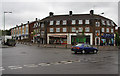
Chesterfield Road and Bells Hill
The junction of these two roads forms part of a circular area allowing terminating buses to turn round. Three sides of the junction have housing, whilst this fourth side has shops and flats. The other side of the circle can be seen in Image
Image: © Martin Addison
Taken: 27 May 2009
0.15 miles
7
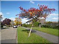
Colourful Tree, Dexter Road
This area is known as Duck's Island. The Barnet Borough website suggests that the name comes from a family called Duck who owned the land in the 17th century. http://www.barnet.gov.uk/info/940044/barnet/740/barnet/3
Image: © Des Blenkinsopp
Taken: 24 Oct 2013
0.15 miles
8
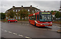
Chesterfield Road and Whitings Road
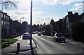
The junction of these roads forms part of a circular area allowing terminating buses to turn around. Here we see a 184 performing that action before starting its return run to Turnpike Lane. See Image for the other side of the circle.
The bus is DWL52 of Arriva, a DAF with Wright bodywork.
Image: © Martin Addison
Taken: 27 May 2009
0.16 miles