IMAGES TAKEN NEAR TO
Southfield, BARNET, EN5 2AT
Introduction
This page details the photographs taken nearby to Southfield, EN5 2AT by members of the Geograph project.
The Geograph project started in 2005 with the aim of publishing, organising and preserving representative images for every square kilometre of Great Britain, Ireland and the Isle of Man.

There are currently over 7.5m images from over14,400 individuals and you can help contribute to the project by visiting https://www.geograph.org.uk
Image Map
Images are licensed for reuse under creativecommons.org/licenses/by-sa/2.0
Notes
- Clicking on the map will re-center to the selected point.
- The higher the marker number, the further away the image location is from the centre of the postcode.
Image Listing (39 Images Found)
Images are licensed for reuse under creativecommons.org/licenses/by-sa/2.0
Image
Details
Distance
1
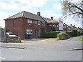
Southfield
Houses on Southfield which, fittingly, back onto a field alongside Dollis Brook.
Image: © Martin Addison
Taken: 1 Apr 2007
0.05 miles
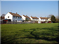
4
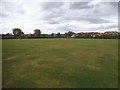
Quinta Open Space by Mays Lane, Barnet
Image: © David Howard
Taken: 13 Aug 2014
0.09 miles
6
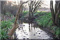
Alongside the Dollis Brook at Totteridge Fields
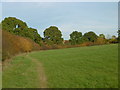
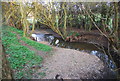
The Dollis Brook rises at Moat Mount near Arkley, firstly flowing eastwards through the open countryside of Totteridge Fields to Chipping Barnet and then through the suburbs of Barnet to Hendon. Its route can be traced by the thin strip of woodland along the riverbank and ribbon of open land on either side which provides a valuable green corridor. At Hendon the Dollis Brook meets the Mutton Brook and becomes the River Brent which then flows into the Welsh Harp Reservoir and subsequently the River Thames at Brentford. The brook is on the left here and this looks downstream.
At Totteridge Fields you could still be in the traditional countryside that was so common before the Second World War, and has been destroyed in so many places since. It is a fine survival of the English pastoral landscape, one of the best in Greater London. The London LOOP passes through Totteridge Fields on its way from High Barnet but turns off west of here to meet Hendon Wood Lane and carry on to Moat Mount Open Space.
Image: © Marathon
Taken: 2 Nov 2016
0.10 miles
9
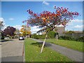
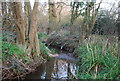
Colourful Tree, Dexter Road
This area is known as Duck's Island. The Barnet Borough website suggests that the name comes from a family called Duck who owned the land in the 17th century. http://www.barnet.gov.uk/info/940044/barnet/740/barnet/3
Image: © Des Blenkinsopp
Taken: 24 Oct 2013
0.12 miles