
IMAGES TAKEN NEAR TO
Station Road, BARNET, EN5 1ST
Introduction
This page details the photographs taken nearby to Station Road, EN5 1ST by members of the Geograph project.
The Geograph project started in 2005 with the aim of publishing, organising and preserving representative images for every square kilometre of Great Britain, Ireland and the Isle of Man.

There are currently over 7.5m images from over14,400 individuals and you can help contribute to the project by visiting https://www.geograph.org.uk
Image Map
Images are licensed for reuse under creativecommons.org/licenses/by-sa/2.0
Notes
- Clicking on the map will re-center to the selected point.
- The higher the marker number, the further away the image location is from the centre of the postcode.
Image Listing (28 Images Found)
Images are licensed for reuse under creativecommons.org/licenses/by-sa/2.0
Image
Details
Distance
1
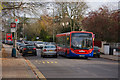
Station Road, New Barnet
DEL853 on the 84 approaches the junction with Warwick Road on route to St.Albans. This vehicle, an Alexander Dennis Enviro 200, has a dot matrix route display which the camera hasn't caught because of its refresh rate.
The 84 route was always an anomaly within the London Transport network, being a red route that went deep into the country bus area. Nowadays the 84 route is not a TFL route (ex London Transport), but is a commercial operation by Metroline, with support from Hertfordshire County Council and support from TFL over the Barnet to Potters Bar section. TfL Oyster cards can only be used on the Barnet-Potters Bar section. Transport for London don't normally allow dot-matrix displays, but as this is not a TfL route the buses are fitted with them. So the 84 continues its record for uniqueness.
A 307 to Brimsdown can be seen in the distance.
Image: © Martin Addison
Taken: 21 Nov 2008
0.01 miles
2
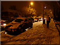
Station Road, Barnet (A110)
Station Road, Barnet, gridlocked by the snow, looking south west.
Image: © Christine Matthews
Taken: 21 Dec 2009
0.03 miles
3
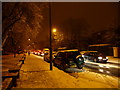
Station Road, Barnet (A110)
Station Road gridlocked by the snow.
Image: © Christine Matthews
Taken: 21 Dec 2009
0.04 miles
4
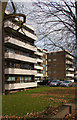
Barnes Court
Apartments set back from Station Road, New Barnet.
Image: © Martin Addison
Taken: 21 Nov 2008
0.04 miles
6
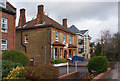
Old and New Housing on Station Road
A large old house beside a modern low-rise apartment block on Station road at the junction with Plantagenet Road. The old house is now a day nursery.
Image: © Martin Addison
Taken: 21 Nov 2008
0.10 miles
7
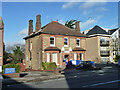
Head Start day nursery, New Barnet
On Station Road.
Image: © Robin Webster
Taken: 25 Nov 2012
0.11 miles
8
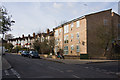
Leicester Road
Seen here at the junction with Warwick Road. Mainly terraced housing but with a new apartment block on the corner.
Image: © Martin Addison
Taken: 21 Nov 2008
0.12 miles
9
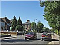
Station Road, East Barnet
Station Road (A110) looking in direction of High Barnet.
Image: © Christine Matthews
Taken: 29 Aug 2005
0.13 miles
10
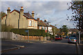
Bulwer Road
Looking down the hill from the junction with Woodville Road. The Gasometer by Victoria Recreation Ground is visible in the distance. The Holly tree on the right was full of Wood Pigeons until I arrived, then they all scattered.
Image: © Martin Addison
Taken: 21 Nov 2008
0.15 miles