
IMAGES TAKEN NEAR TO
Grange Avenue, BARNET, EN4 8NL
Introduction
This page details the photographs taken nearby to Grange Avenue, EN4 8NL by members of the Geograph project.
The Geograph project started in 2005 with the aim of publishing, organising and preserving representative images for every square kilometre of Great Britain, Ireland and the Isle of Man.

There are currently over 7.5m images from over14,400 individuals and you can help contribute to the project by visiting https://www.geograph.org.uk
Image Map
Images are licensed for reuse under creativecommons.org/licenses/by-sa/2.0
Notes
- Clicking on the map will re-center to the selected point.
- The higher the marker number, the further away the image location is from the centre of the postcode.
Image Listing (94 Images Found)
Images are licensed for reuse under creativecommons.org/licenses/by-sa/2.0
Image
Details
Distance
1
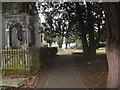
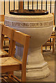
St Mary's Churchyard, East Barnet
The nave walls and three small windows in the north wall are early Norman. The rest of the church dates from the 19th century. The tower dates from 1829. For a more detailed history of the church see http://www.stmarys-eastbarnet.org.uk/?page_id=50 A very attractive series of photographs of the churchyard and church can be seen at http://www.stmarys-eastbarnet.org.uk/?page_id=3995
St Mary's has a particularly attractive churchyard with some fine tombs and monuments. More about the churchyard can be seen at http://www.stmarys-eastbarnet.org.uk/?page_id=141 and biographies of a few of the interesting people interred here can be found at http://www.stmarys-eastbarnet.org.uk/?page_id=163
Image: © Marathon
Taken: 17 Feb 2016
0.11 miles
6
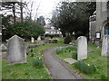
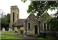
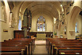
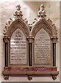
St Mary's Churchyard, East Barnet
The nave walls and three small windows in the north wall are early Norman. The rest of the church dates from the 19th century. The tower dates from 1829. For a more detailed history of the church see http://www.stmarys-eastbarnet.org.uk/?page_id=50 A very attractive series of photographs of the churchyard and church can be seen at http://www.stmarys-eastbarnet.org.uk/?page_id=3995
St Mary's has a particularly attractive churchyard with some fine tombs and monuments. More about the churchyard can be seen at http://www.stmarys-eastbarnet.org.uk/?page_id=141 and biographies of a few of the interesting people interred here can be found at http://www.stmarys-eastbarnet.org.uk/?page_id=163
Image: © Marathon
Taken: 17 Feb 2016
0.11 miles
8
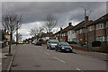
Alverstone Avenue
Seen from the corner at the southern end of this street. Semi-detached houses march up the hill. New street lighting has recently been installed - something being done throughout the Borough of Barnet in 2009/2010 - and the street light on the right has been decommissioned. It awaits the final removal of the pole to complete the job.
Image: © Martin Addison
Taken: 26 Feb 2010
0.12 miles
9
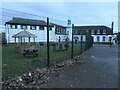
The former Church Farm Industrial School
Founded in 1860. Industrial Schools provided children with training and education, instead of imprisonment or other punishment. In the 1930s it became an Approved School for 105 boys aged between 13 and 15. The buildings are now used by Oak Hill School, the only school in the AP Barnet Multi Acadamy Trust.
Image: © Christine Johnstone
Taken: 25 Dec 2022
0.12 miles
10
Burlington Rise at the junction of Avondale Avenue
Image: © David Howard
Taken: 25 Sep 2013
0.12 miles