IMAGES TAKEN NEAR TO
Gallants Farm Road, BARNET, EN4 8EL
Introduction
This page details the photographs taken nearby to Gallants Farm Road, EN4 8EL by members of the Geograph project.
The Geograph project started in 2005 with the aim of publishing, organising and preserving representative images for every square kilometre of Great Britain, Ireland and the Isle of Man.

There are currently over 7.5m images from over14,400 individuals and you can help contribute to the project by visiting https://www.geograph.org.uk
Image Map
Images are licensed for reuse under creativecommons.org/licenses/by-sa/2.0
Notes
- Clicking on the map will re-center to the selected point.
- The higher the marker number, the further away the image location is from the centre of the postcode.
Image Listing (102 Images Found)
Images are licensed for reuse under creativecommons.org/licenses/by-sa/2.0
Image
Details
Distance
1
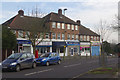
Gallants Farm Road, East Barnet
As is so often the case with suburban shopping parades, most of the units here have become rather specialist facilities, offering bathrooms, tattoos and dog grooming amongst other things. On the other hand the 'Food 'n' Wine' shop appears no longer to be functional.
Image: © Stephen McKay
Taken: 6 Feb 2017
0.02 miles
2
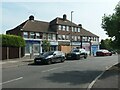
Parade of shops, Gallants Farm Road
Shopping habits have changes since these shops were built in the 1950s. One is now being converted to a flat, one at least is out of use, and the others offer specialist, not daily, services and purchases.
Image: © Christine Johnstone
Taken: 6 Sep 2021
0.03 miles
3
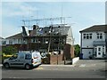
Extending another house in Gallants Farm Road
Already extended sideways, now extending into the roof space.
Image: © Christine Johnstone
Taken: 6 Sep 2021
0.04 miles
4

Albemarle Road, off Alverstone Avenue
Looking north towards the valley of Pymes Brook.
Image: © Christine Johnstone
Taken: 6 Sep 2021
0.07 miles
5
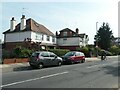
Cyclist on Alverstone Avenue
Passing houses that have been extended, as many have in this part of North London. The houses were built in the 1920s or early 1930s.
Image: © Christine Johnstone
Taken: 6 Sep 2021
0.09 miles
6
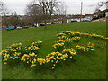
Daffodils at Rushdene Avenue, East Barnet
Rushdene Avenue passes either side of this small green.
Image: © Marathon
Taken: 17 Feb 2016
0.10 miles
7
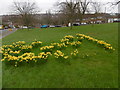
Daffodils at Rushdene Avenue, East Barnet
Rushdene Avenue passes either side of this small green. Beyond it dips down to the valley of the Pymme's Brook in Oak Hill Park.
Image: © Marathon
Taken: 17 Feb 2016
0.11 miles
8
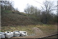
In a railway cutting, East Barnet
The East Coast Main Line.
Image: © N Chadwick
Taken: 25 Feb 2011
0.11 miles
9
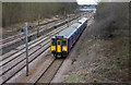
Semi-fast to London
A class 317 electric multiple unit of First Capital Connect passes through the cutting south of Oakleigh Park station.
The line here is built on the side of the valley created by Pymmes Brook and the land to the west is higher than that on the right hand side of the photo, which possibly is the reason why the down slow track at this location is raised above the other running tracks.
Image: © Martin Addison
Taken: 26 Feb 2010
0.14 miles