
IMAGES TAKEN NEAR TO
Lancaster Road, BARNET, EN4 8AJ
Introduction
This page details the photographs taken nearby to Lancaster Road, EN4 8AJ by members of the Geograph project.
The Geograph project started in 2005 with the aim of publishing, organising and preserving representative images for every square kilometre of Great Britain, Ireland and the Isle of Man.

There are currently over 7.5m images from over14,400 individuals and you can help contribute to the project by visiting https://www.geograph.org.uk
Image Map
Images are licensed for reuse under creativecommons.org/licenses/by-sa/2.0
Notes
- Clicking on the map will re-center to the selected point.
- The higher the marker number, the further away the image location is from the centre of the postcode.
Image Listing (41 Images Found)
Images are licensed for reuse under creativecommons.org/licenses/by-sa/2.0
Image
Details
Distance
1
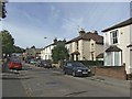
Henry Road looking South-West towards Lancaster Road
Image: © Christine Matthews
Taken: 28 Sep 2005
0.11 miles
2
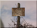
Railway warning sign
This warning to trespassers was on the embankment by the bridge in Longmore Avenue, New Barnet until about 2005 but has since disappeared
Image: © Ken Amphlett
Taken: 9 Mar 2003
0.13 miles
4
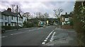
Longmore Avenue, New Barnet
This picture is taken from the East side of the bridge. On the left hand side just before the bridge can be seen the Jet petrol station which was demolished in the early 00's and was replaced by flats some time later
Image: © Ken Amphlett
Taken: Unknown
0.14 miles
5
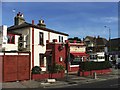
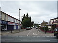
Restaurant on Corner of Henry Road and East Barnet Road
"Chez Tonton" Restaurant on corner of Henry Road and East Barnet Road. I think the building was probably a private house at one time.
Image: © Christine Matthews
Taken: 28 Sep 2005
0.14 miles
8
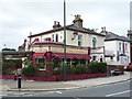
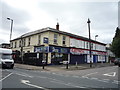
Chez Tonton
French restaurant on East Barnet Road.
Image: © JThomas
Taken: 3 Sep 2016
0.15 miles
9
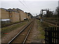
View from the end of the platform at New Barnet station
The Great Northern Railway opened its line between Maiden Lane and Peterborough on 7th August 1850 on which date Barnet station opened. On 1st May 1884, the station was renamed New Barnet.
This is the view from the end of the up slow platform. Trains go from here to Moorgate. To the left is a siding. The fast lines are to the right. As is the case with many stations now, where it is feasible as here, the fast lines are protected by railings. The next station in this direction is Oakleigh Park.
Image: © Marathon
Taken: 17 Feb 2016
0.16 miles
10
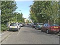
Lancaster Road, East Barnet
Lancaster Road East Barnet looking south-west.
Image: © Christine Matthews
Taken: 28 Sep 2005
0.16 miles