IMAGES TAKEN NEAR TO
Beech Hill, BARNET, EN4 0JN
Introduction
This page details the photographs taken nearby to Beech Hill, EN4 0JN by members of the Geograph project.
The Geograph project started in 2005 with the aim of publishing, organising and preserving representative images for every square kilometre of Great Britain, Ireland and the Isle of Man.

There are currently over 7.5m images from over14,400 individuals and you can help contribute to the project by visiting https://www.geograph.org.uk
Image Map
Images are licensed for reuse under creativecommons.org/licenses/by-sa/2.0
Notes
- Clicking on the map will re-center to the selected point.
- The higher the marker number, the further away the image location is from the centre of the postcode.
Image Listing (46 Images Found)
Images are licensed for reuse under creativecommons.org/licenses/by-sa/2.0
Image
Details
Distance
1
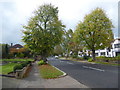
Lancaster Avenue, Hadley Wood
Lancaster Avenue leads uphill to Hadley Wood station. Interwar houses in the 'Tudorbethan' style can be seen on the right.
Image: © Marathon
Taken: 11 Oct 2017
0.11 miles
2
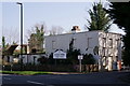
Hadley Wood Golf Club
The entrance, seen from Beech Hill.
Image: © Peter Trimming
Taken: 1 Apr 2019
0.13 miles
3
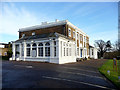
Club House, Hadley Wood Golf Course, Beech Hill, Cockfosters
As seen from the car park.
Image: © Christine Matthews
Taken: 19 Jan 2012
0.16 miles
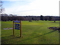
4
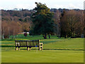
Hadley Wood Golf Course, Beech Hill, Cockfosters
A quiet place to sit at Hadley Wood Golf Course.
Image: © Christine Matthews
Taken: 19 Jan 2012
0.17 miles
5
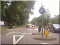
Mini roundabout on the junction of Cockfosters Road and Beech Hill
Image: © David Howard
Taken: 19 Jul 2012
0.17 miles
6
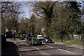
Cockfosters Road
This is the A111, on the eastern edge of Hadley Wood.
Image: © Peter Trimming
Taken: 1 Apr 2019
0.17 miles
7
Hadley Wood Golf Course, Beech Hill, Cockfosters
Looking south-east across the greens.
Image: © Christine Matthews
Taken: 19 Jan 2012
0.18 miles
8

Hadley Wood Golf Course, Hadley Wood, Barnet, Hertfordshire
Image: © Christine Matthews
Taken: 25 Oct 2015
0.18 miles
9
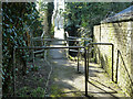
Footbridge on path from Cockfosters Road to Kingwell Road
Monken Mead Brook is crossed.
Image: © Robin Webster
Taken: 6 Apr 2013
0.18 miles
10
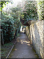
Footpath from Cockfosters Road to Kingwell Road, Hadley Wood
Image: © Robin Webster
Taken: 6 Apr 2013
0.18 miles