
IMAGES TAKEN NEAR TO
Leaside Business Centre, ENFIELD, EN3 7BJ
Introduction
This page details the photographs taken nearby to Leaside Business Centre, EN3 7BJ by members of the Geograph project.
The Geograph project started in 2005 with the aim of publishing, organising and preserving representative images for every square kilometre of Great Britain, Ireland and the Isle of Man.

There are currently over 7.5m images from over14,400 individuals and you can help contribute to the project by visiting https://www.geograph.org.uk
Image Map
Images are licensed for reuse under creativecommons.org/licenses/by-sa/2.0
Notes
- Clicking on the map will re-center to the selected point.
- The higher the marker number, the further away the image location is from the centre of the postcode.
Image Listing (48 Images Found)
Images are licensed for reuse under creativecommons.org/licenses/by-sa/2.0
Image
Details
Distance
1
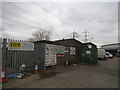
Industrial site on Millmarsh Lane, Brimsdown
Image: © David Howard
Taken: 18 Feb 2018
0.01 miles
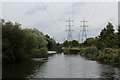
3
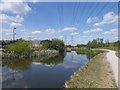
River Lee Navigation at Brimsdown
The original River Lea flowed 70 miles from Leagrove Marsh near Luton to the River Thames at Bow Creek. The River Lee Act of 1766 provided for the construction of 15 new cuts to straighten the course of the river by eliminating loops which made it difficult to navigate. This is one of those cuts and hence it is a navigation rather than a river. The Lea passes a little further to the east here, beyond King George's Reservoir. Historically the river is spelled Lea while the navigation is Lee.
Just ahead on the right is the embankment of King George's Reservoir. The excavation and building of the surrounding embankment of the reservoir, nearly five miles in length, was carried out almost entirely by a manual labour force of 1,000 navvies, and the surplus excavated clay was spread over part of Hackney Marsh. In 1913 King George Vth and Queen Mary named the reservoir and pressed the buttons allowing water from the River Lea to start flowing into the storage bowl.
Image: © Marathon
Taken: 19 Apr 2017
0.02 miles
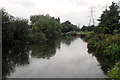
6
Enfield Sea Cadets
A waterside base not quite up to the standard of their neighbours downstream - Image
Image: © Robin Webster
Taken: 20 Oct 2012
0.03 miles
8
National Cycle Route 1, River Lea Valley
Bend in the River Lea Navigation, Brimsdown.
Image: © JThomas
Taken: 20 Jul 2019
0.03 miles
9

River Lea, Enfield
River Lea showing barges with electricity pylons and industrial area in the background in the late afternoon winter sunshine.
Image: © Christine Matthews
Taken: Unknown
0.04 miles
10
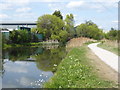
River Lee Navigation at Brimsdown
The original River Lea flowed 70 miles from Leagrove Marsh near Luton to the River Thames at Bow Creek. The River Lee Act of 1766 provided for the construction of 15 new cuts to straighten the course of the river by eliminating loops which made it difficult to navigate. This is one of those cuts and hence it is a navigation rather than a river. The Lea passes a little further to the east here, beyond King George's Reservoir. Historically the river is spelled Lea while the navigation is Lee.
Out of sight to the right in this photograph is the embankment of King George's Reservoir. The excavation and building of the surrounding embankment of the reservoir, nearly five miles in length, was carried out almost entirely by a manual labour force of 1,000 navvies, and the surplus excavated clay was spread over part of Hackney Marsh. In 1913 King George Vth and Queen Mary named the reservoir and pressed the buttons allowing water from the River Lea to start flowing into the storage bowl.
Millmarsh Lane on the industrial estate at Brimsdown is on the other side of the River Lee Navigation here.
Image: © Marathon
Taken: 19 Apr 2017
0.04 miles