
IMAGES TAKEN NEAR TO
Tingeys Top Lane, ENFIELD, EN2 9BJ
Introduction
This page details the photographs taken nearby to Tingeys Top Lane, EN2 9BJ by members of the Geograph project.
The Geograph project started in 2005 with the aim of publishing, organising and preserving representative images for every square kilometre of Great Britain, Ireland and the Isle of Man.

There are currently over 7.5m images from over14,400 individuals and you can help contribute to the project by visiting https://www.geograph.org.uk
Image Map
Images are licensed for reuse under creativecommons.org/licenses/by-sa/2.0
Notes
- Clicking on the map will re-center to the selected point.
- The higher the marker number, the further away the image location is from the centre of the postcode.
Image Listing (39 Images Found)
Images are licensed for reuse under creativecommons.org/licenses/by-sa/2.0
Image
Details
Distance
1
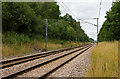
Hertford Loop Line
Looking towards Crews Hill station from a foot crossing on the footpath between Strayfield Road and Cattlegate Road.
Image: © Martin Addison
Taken: 26 Jul 2010
0.12 miles
3
Ash Ride looking towards Cypress Avenue
Image: © David Howard
Taken: 18 Jul 2014
0.12 miles
4
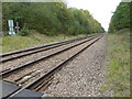
Looking towards Cuffley station
So far as I am aware this is the only foot crossing (other than normal level crossings) over a normal railway in Greater London. It lies between Gordon Hill station, which is behind, and Crews Hill station ahead. A view of the crossing itself can be seen at http://www.geograph.org.uk/photo/5567137
The Alexandra Palace-Hertford-Stevenage loop was built mainly as a by-pass for the approaches to King's Cross on the main line from Hatfield and was built to main line standards for much of its length. However, it has never carried regular long-distance passenger services and has always primarily been a suburban branch, apart from when there is engineering work or other disruption on the East Coast Main Line through Hatfield.
The line was opened as far as Enfield, which was then the terminus, on 1st April 1871. The line was extended to Cuffley from 4th April 1910 and on to Stevenage for freight on 4th March 1918, but passenger trains only started beyond Cuffley on 2nd June 1924.
North of Gordon Hill the line was laid across undulating countryside, its stations seeing only golfers and walkers. Crews Hill station opened with the line between Enfield and Cuffley on 4th April 1910 but only served a golf course, a few nurserymen’s greenhouses and a stud farm. This section is still rural and mostly lies in the Green Belt.
Image: © Marathon
Taken: 11 Oct 2017
0.12 miles
5
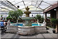
Fountain at the coffee shop, The Gardening Club Nursery
One of the largest covered garden centre clubs in the UK open to the public, The Gardening Club is based in Crews Hill, Enfield with over 30 acres of glass covered garden products and plants for sale.
Image: © Richard Hoare
Taken: 23 May 2016
0.12 miles
6
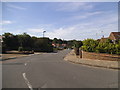
Golf Ride, Crews Hill
This is the only residential estate in Crews Hill, apart from some houses scattered on the main roads. Most of the area is market gardening.
Image: © David Howard
Taken: 18 Jul 2014
0.13 miles

8
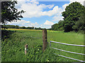
Gate and LOOP Waymark
The London Loop long distance path makes a right angle turn here by the gate to this grassy meadow.
The trademark green Loop waymarks can be seen on the post.
Image: © Des Blenkinsopp
Taken: 5 Jun 2014
0.16 miles
9
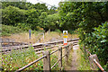
Stop Look Listen
A railway foot crossing on the Hertford Loop line. These are relatively rare in the London area as traffic volumes are usually considered high enough to warrant a footbridge. It perhaps is a comment on the Great Northern Railway's financial situation - it didn't have much to spare and the same was the case for its successor, the LNER.
Image: © Martin Addison
Taken: 26 Jul 2010
0.16 miles
10
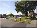
Rosewood Drive at the junction of Beech Avenue
Image: © David Howard
Taken: 18 Jul 2014
0.16 miles