
IMAGES TAKEN NEAR TO
Friar Road, ENFIELD, EN2 8FZ
Introduction
This page details the photographs taken nearby to Friar Road, EN2 8FZ by members of the Geograph project.
The Geograph project started in 2005 with the aim of publishing, organising and preserving representative images for every square kilometre of Great Britain, Ireland and the Isle of Man.

There are currently over 7.5m images from over14,400 individuals and you can help contribute to the project by visiting https://www.geograph.org.uk
Image Map
Images are licensed for reuse under creativecommons.org/licenses/by-sa/2.0
Notes
- Clicking on the map will re-center to the selected point.
- The higher the marker number, the further away the image location is from the centre of the postcode.
Image Listing (64 Images Found)
Images are licensed for reuse under creativecommons.org/licenses/by-sa/2.0
Image
Details
Distance
1
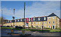
Locksley Place, a new terrace
New housing with a traditional look on former hospital land at Chase Farm.
Image: © Des Blenkinsopp
Taken: 17 Oct 2019
0.03 miles
2
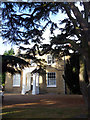
Entrance to House, The Ridgeway, Enfield
Looking towards the entrance doorway of this house. The Cedar of Lebanon tree can be seen on the right. The house is located close to the junction with Lavender Hill.
Image: © Christine Matthews
Taken: 25 Oct 2009
0.04 miles
3
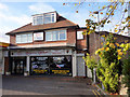
Ridgeway Garage, Enfield
This building is the original house adjacent to the Petrol Filling Station and containing the reception area for the garage.
Image: © Christine Matthews
Taken: 25 Oct 2009
0.05 miles
4
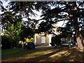
House in The Ridgeway, Enfield
This house has a large Cedar of Lebanon tree in the garden which can be seen in this photograph. The house is located at the junction with Lavender Hill.
Image: © Christine Matthews
Taken: 25 Oct 2009
0.05 miles
5
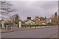
The Ridgeway Tavern, Enfield
The Ridgeway Tavern is a public house, which is an Ember Inn. It is just before the junction of the Ridgeway with Lavender Hill, if you are approaching from a southerly direction.
Image: © Christine Matthews
Taken: 24 Feb 2008
0.07 miles
6
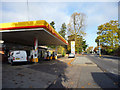
Shell Garage, The Ridgeway, Enfield
The Shell Garage is near the junction with Lavender Hill.
Image: © Christine Matthews
Taken: 25 Oct 2009
0.07 miles
7
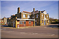
Postgraduate Block, Chase Farm Hospital, The Ridgeway, Enfield
Just to the right of the entrance is the Postgraduate Block.
Image: © Christine Matthews
Taken: 11 Oct 2008
0.08 miles
8
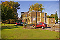
Chase Farm Hospital, The Ridgeway, Enfield
Just to the left inside the entrance are these original buildings,now occupied by Middlesex University, Chase Farm Campus.
Image: © Christine Matthews
Taken: 11 Oct 2008
0.08 miles
9
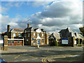
Older buildings, Chase Farm Hospital Site
These were the receiving ward block and the lodge for Chase Farm Schools, which seem to have been residential schools for children on poor relief.
Image: © Robin Webster
Taken: 3 Nov 2012
0.08 miles
10
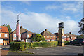
Outside The Ridgeway
In front of a pub named after the road it's on.
Image: © Des Blenkinsopp
Taken: 17 Oct 2019
0.08 miles