
IMAGES TAKEN NEAR TO
Enfield Road, ENFIELD, EN2 7QS
Introduction
This page details the photographs taken nearby to Enfield Road, EN2 7QS by members of the Geograph project.
The Geograph project started in 2005 with the aim of publishing, organising and preserving representative images for every square kilometre of Great Britain, Ireland and the Isle of Man.

There are currently over 7.5m images from over14,400 individuals and you can help contribute to the project by visiting https://www.geograph.org.uk
Image Map
Images are licensed for reuse under creativecommons.org/licenses/by-sa/2.0
Notes
- Clicking on the map will re-center to the selected point.
- The higher the marker number, the further away the image location is from the centre of the postcode.
Image Listing (74 Images Found)
Images are licensed for reuse under creativecommons.org/licenses/by-sa/2.0
Image
Details
Distance
1
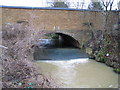
Salmon's Brook: A110 road bridge
Salmon's Brook passes under the A110 road through this bridge and over the weir. At this point the road name changes from Enfield Road on the Oakwood side to the left to Slades Hill on the Enfield side to the right. The brook was carrying far more water and sediment than usual after several rainy days.
Image: © Nigel Cox
Taken: 17 Jan 2008
0.00 miles
2
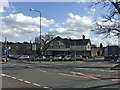
Jolly Farmers Public House, Frog's Bottom, Enfield
Jolly Farmer's Public House in the Enfield Road in an area called Frog's Bottom. Once over the bridge taking the A110 across Salmon's Brook towards Enfield, the road name changes to Slades Hill.
Image: © Christine Matthews
Taken: 2 Mar 2007
0.01 miles
3
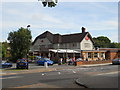
The Jolly Farmers, Enfield
The Jolly Farmers is located at the junction of Enfield Road and Links Side in an area known as Frog's Bottom. The pub, which was extensively refurbished in 2012, has been owned by the Hertford-based McMullen brewery since 1910. It was proving highly popular here on an unusually warm Sunday lunchtime in late September 2014.
Source: https://www.mcmullens.co.uk/jollyfarmers
Image: © Paul Bryan
Taken: 28 Sep 2014
0.01 miles
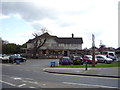
5
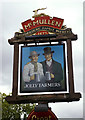
Pub Sign for the Jolly Farmers, Enfield Road, Enfield
The Jolly Farmers public house is situated in the valley, adjacent to Salmon's Brook, at the end of the Enfield Road (A110) just before it becomes Slades Hill, an area known as Frog's Bottom, as you will see from my image of the other side of the sign. It looks as though the Frog's Bottom notice has been torn off on this side.
Image: © Christine Matthews
Taken: 7 Oct 2008
0.02 miles
6
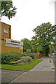
Links Side, Enfield
Looking up Links Side towards the Enfield Road (A110), with the parade of shops and postbox.
Image: © Christine Matthews
Taken: 7 Oct 2008
0.02 miles
7
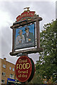
Pub Sign for Jolly Farmers Public House, Frog's Bottom, Enfield
Pub sign for the Jolly Farmers public house. This side has the additional sign for this area, which is called Frog's Bottom. The Jolly Farmers is situated adjacent to Salmon's Brook in the Enfield Road (A110) just before that road becomes Slades Hill.
Image: © Christine Matthews
Taken: 7 Oct 2008
0.02 miles
8
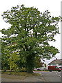
Large Oak Tree on corner of Links Side, Enfield
On the corner of Links Side and the Enfield Road (A110) there is this large oak tree.
Image: © Christine Matthews
Taken: 7 Oct 2008
0.02 miles
9
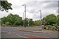
Corner of Links Side, Enfield
Looking across Links Side towards the Enfield Road (A110) we can see the pub sign for the Jolly Farmers public house. On the other side of the road is a small field where black and white coated sheep are often grazing. Salmon's Brook goes under the road just outside this image on the right.
Image: © Christine Matthews
Taken: 7 Oct 2008
0.02 miles
10
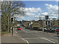
Slades Hill, looking east towards Enfield Chase
Slades Hill from Frog's Bottom, looking towards Enfield.
Image: © Christine Matthews
Taken: 2 Mar 2007
0.02 miles