
IMAGES TAKEN NEAR TO
Merryhills Drive, ENFIELD, EN2 7PD
Introduction
This page details the photographs taken nearby to Merryhills Drive, EN2 7PD by members of the Geograph project.
The Geograph project started in 2005 with the aim of publishing, organising and preserving representative images for every square kilometre of Great Britain, Ireland and the Isle of Man.

There are currently over 7.5m images from over14,400 individuals and you can help contribute to the project by visiting https://www.geograph.org.uk
Image Map
Images are licensed for reuse under creativecommons.org/licenses/by-sa/2.0
Notes
- Clicking on the map will re-center to the selected point.
- The higher the marker number, the further away the image location is from the centre of the postcode.
Image Listing (411 Images Found)
Images are licensed for reuse under creativecommons.org/licenses/by-sa/2.0
Image
Details
Distance
1
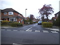
Culgath Gardens at the junction of Merryhills Drive
Image: © David Howard
Taken: 27 Mar 2014
0.02 miles
2
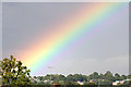
Rainbow's End, Enfield
Looking across Enfield towards the Ridgeway.
Image: © Christine Matthews
Taken: 25 Aug 2012
0.03 miles
3
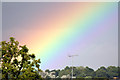
Rainbow's End, Enfield
Looking towards Enfield, the rainbow ends behind the oak tree.
Image: © Christine Matthews
Taken: 25 Aug 2012
0.07 miles
4

Sunrise, London N14
Looking north-east. The spire of St Mary Magdalene on Windmill Hill can be seen.
Image: © Christine Matthews
Taken: 7 Apr 2013
0.09 miles
5

Sunrise, London N14
Looking north-east. The spire of St Mary Magdalene on Windmill Hill can be seen.
Image: © Christine Matthews
Taken: 7 Apr 2013
0.11 miles
6

Sunrise, London N14
Looking north-east. The spire of St Mary Magdalene on Windmill Hill can be seen. I liked the added interest of the three geese which were flying over at the time.
Image: © Christine Matthews
Taken: 7 Apr 2013
0.11 miles
7
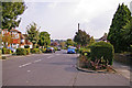
Merryhills Drive, Enfield, Middlesex
Looking down Merryhills Drive from the other side of the road to Greystoke Gardens in the direction of Boxer's Lake.
Image: © Christine Matthews
Taken: 22 Sep 2008
0.11 miles
8

Sunrise over Enfield
The spire of St Mary Magdalene can be seen to the right of the image.
Image: © Christine Matthews
Taken: 16 Nov 2013
0.11 miles
9
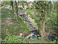
Stream, Lonsdale Drive, Enfield
A small wetland area is being created where this gully opens up into a stream before feeding Boxer's Lake.
Image: © Christine Matthews
Taken: 16 Apr 2015
0.12 miles
10

Sunlit view of Enfield
Looking across from close to what was at one time the boundary of the Borough of Southgate and the Borough of Enfield, we have the late afternoon sunset shining on the windows and the spire of St Mary Magdalene on the junction of Windmill Hill, The Ridgeway and Slades Hill.
Image: © Christine Matthews
Taken: 27 Mar 2009
0.12 miles