1
Woodland, Lonsdale Drive, Enfield
Lonsdale Drive divides into two roads where the stream that feeds Boxer's Lake emerges from the culvert. Here see the woodland from the north side of Lonsdale Drive. Some of the houses on the south side of Lonsdale Drive can be seen through the trees. Most of the houses on the south side are prefabricated houses constructed after World War II, although some were replaced when an access route to the Highlands Estate was constructed. There are also some of the Laing houses similar to those on the north side. The Laing estate was constructed in the 1930s, but building stopped with the onset of war and after the war it was necessary to provide housing quickly, so the prefabricated homes were built.
Image: © Christine Matthews
Taken: 4 Feb 2009
0.00 miles
2
Wooded area Lonsdale Drive, Enfield
Footpath beside stream in wooded area of Lonsdale Drive.
Image: © Christine Matthews
Taken: 26 Apr 2008
0.02 miles
3
Stream, Lonsdale Drive, Enfield
A small wetland area is being created where this gully opens up into a stream before feeding Boxer's Lake.
Image: © Christine Matthews
Taken: 16 Apr 2015
0.03 miles
4
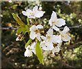
Blossom on tree in wooded area, Lonsdale Drive, Enfield
Image: © Christine Matthews
Taken: 26 Apr 2008
0.03 miles
5
Wooded area Lonsdale Drive, Enfield
Young leaves in woodland near stream in Lonsdale Drive.
Image: © Christine Matthews
Taken: 26 Apr 2008
0.03 miles
6
Woodland, Lonsdale Drive, Enfield
Lonsdale Drive divides into two roads where the stream that feeds Boxer's Lake emerges from the culvert. Here see the woodland from the north side of Lonsdale Drive. Some of the houses on the south side of Lonsdale Drive can be seen through the trees. Most of the houses on the south side are prefabricated houses constructed after World War II, although some were replaced when an access route to the Highlands Estate was constructed. There are also some of the Laing houses similar to those on the north side. The Laing estate was constructed in the 1930s, but building stopped with the onset of war and after the war it was necessary to provide housing quickly, so the prefabricated homes were built.
Image: © Christine Matthews
Taken: 4 Feb 2009
0.03 miles
7
Lonsdale Drive, Enfield
Image: © Paul Bryan
Taken: 15 Oct 2017
0.04 miles
8
Stream, Lonsdale Drive, Enfield
A small wetland area is being created where this gully opens up into a stream before feeding Boxer's Lake.
Image: © Christine Matthews
Taken: 16 Apr 2015
0.04 miles
9
Stream, wooded area, Lonsdale Drive, Enfield
Spring foliage on edge of stream in Lonsdale Drive.
Image: © Christine Matthews
Taken: 26 Apr 2008
0.05 miles
10
Woodland, Lonsdale Drive, Enfield
Lonsdale Drive divides into two roads where the stream that feeds Boxer's Lake emerges from the culvert. Here see the woodland from the north side of Lonsdale Drive not far from the junction with Merrihills Drive. Some of the houses on the south side of Lonsdale Drive can be seen through the trees. Most of the houses on the south side are prefabricated houses constructed after World War II, although some were replaced when an access route to the Highlands Estate was constructed. There are also some of the Laing houses similar to those on the north side. The Laing estate was constructed in the 1930s, but building stopped with the onset of war and after the war it was necessary to provide housing quickly, so the prefabricated homes were built.
Image: © Christine Matthews
Taken: 4 Feb 2009
0.06 miles


