IMAGES TAKEN NEAR TO
Calshot Way, ENFIELD, EN2 7BQ
Introduction
This page details the photographs taken nearby to Calshot Way, EN2 7BQ by members of the Geograph project.
The Geograph project started in 2005 with the aim of publishing, organising and preserving representative images for every square kilometre of Great Britain, Ireland and the Isle of Man.

There are currently over 7.5m images from over14,400 individuals and you can help contribute to the project by visiting https://www.geograph.org.uk
Image Map (Loading...)


Getting Data...Please wait
Leaflet Map data © OpenStreetMap
Images are licensed for reuse under creativecommons.org/licenses/by-sa/2.0
Notes
- Clicking on the map will re-center to the selected point.
- The higher the marker number, the further away the image location is from the centre of the postcode.
Image Listing (149 Images Found)
Images are licensed for reuse under creativecommons.org/licenses/by-sa/2.0
Image
Details
Distance
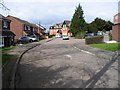
1
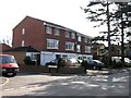
Waverley Road to Badgers Close, Enfield
Image: © John Salmon
Taken: 10 Mar 2007
0.03 miles
2
Crescent Road into Old Park Road, Enfield
Image: © John Salmon
Taken: 10 Mar 2007
0.04 miles
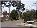
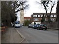
5

Junction of Waverley Road with Windmill Hill, Enfield
Looking up Windmill Hill towards St Mary Magdalene church from the corner of Waverley Road.
Image: © Christine Matthews
Taken: 11 Sep 2008
0.06 miles
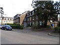
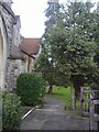
6
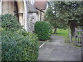
Entrance to the church, The Ridgeway, Enfield
Image: © David Howard
Taken: 11 Feb 2009
0.06 miles
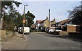
7
Old Park Road towards St Mary Magdalene's Church, Enfield
Image: © John Salmon
Taken: 10 Mar 2007
0.06 miles
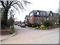
10
St Mary Magdalene church and churchyard, Enfield
On the corner of The Ridgeway and Windmill Hill.
Image: © David Howard
Taken: 11 Feb 2009
0.08 miles