
IMAGES TAKEN NEAR TO
Windmill Hill, ENFIELD, EN2 7AF
Introduction
This page details the photographs taken nearby to Windmill Hill, EN2 7AF by members of the Geograph project.
The Geograph project started in 2005 with the aim of publishing, organising and preserving representative images for every square kilometre of Great Britain, Ireland and the Isle of Man.

There are currently over 7.5m images from over14,400 individuals and you can help contribute to the project by visiting https://www.geograph.org.uk
Image Map
Images are licensed for reuse under creativecommons.org/licenses/by-sa/2.0
Notes
- Clicking on the map will re-center to the selected point.
- The higher the marker number, the further away the image location is from the centre of the postcode.
Image Listing (229 Images Found)
Images are licensed for reuse under creativecommons.org/licenses/by-sa/2.0
Image
Details
Distance
1

Windmill Hill looking towards Enfield Chase, Enfield
Looking down Windmill Hill from near the corner with Waverley Road.
Image: © Christine Matthews
Taken: 11 Sep 2008
0.01 miles
2

Shops, Windmill Hill, Enfield
Parade of shops on the north side of Windmill Hill.
Image: © Christine Matthews
Taken: 11 Sep 2008
0.01 miles
3
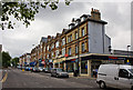
Windmill Hill
The long drag up from Enfield town centre on the A110 to the junction with The Ridgeway. The north side of the street is lined with parades of shops with flats above. In the nearest group, the building currently housing Tesco Metro was clearly built at a different time to its neighbouring shops. I would guess that it pre-dates them as development normally moves outward from the town centre.
Image: © Martin Addison
Taken: 26 Jul 2010
0.02 miles
4
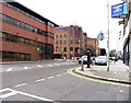
Florence Avenue into Windmill Hill, Enfield
Image: © John Salmon
Taken: 10 Mar 2007
0.02 miles
6

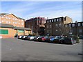
Shops corner Windmill Hill and Chase Court Gardens, Enfield
Shops in Windmill Hill. The corner shop is presently the Burlington Fish Restaurant.
Image: © Christine Matthews
Taken: 11 Sep 2008
0.05 miles
7
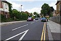
Bycullah Road
View NNW along Bycullah Road from the junction with Windmill Hill.
Image: © David P Howard
Taken: 24 Jul 2014
0.05 miles
8

Junction of Waverley Road with Windmill Hill, Enfield
Looking across Windmill Hill from Waverley Road. Bycullah Road can be seen on the right. The house on the corner has a date notification on the wall of 1927 as the date of building.
Image: © Christine Matthews
Taken: 11 Sep 2008
0.05 miles
9

House on corner Bycullah Road, Enfield
Imposing house on corner of Bycullah Road and Windmill Hill. The house was built in 1927 according to the date embossed on the walls. St Mary Magdalene can be seen in the corner of the image.
Image: © Christine Matthews
Taken: 11 Sep 2008
0.05 miles
10
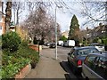
Waverley Road towards Windmill Hill, Enfield
Image: © John Salmon
Taken: 10 Mar 2007
0.06 miles