
IMAGES TAKEN NEAR TO
Trinity Street, ENFIELD, EN2 6NT
Introduction
This page details the photographs taken nearby to Trinity Street, EN2 6NT by members of the Geograph project.
The Geograph project started in 2005 with the aim of publishing, organising and preserving representative images for every square kilometre of Great Britain, Ireland and the Isle of Man.

There are currently over 7.5m images from over14,400 individuals and you can help contribute to the project by visiting https://www.geograph.org.uk
Image Map
Images are licensed for reuse under creativecommons.org/licenses/by-sa/2.0
Notes
- Clicking on the map will re-center to the selected point.
- The higher the marker number, the further away the image location is from the centre of the postcode.
Image Listing (58 Images Found)
Images are licensed for reuse under creativecommons.org/licenses/by-sa/2.0
Image
Details
Distance
1
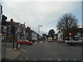
Chase Side at the junction of Parsonage Lane
Image: © David Howard
Taken: 23 Oct 2014
0.09 miles
2
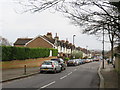
Holtwhite's Hill, Enfield
A view down Holtwhite's Hill in Enfield, in the outer suburbs of north London.
Image: © Malc McDonald
Taken: 22 Feb 2020
0.10 miles
3
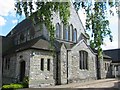
St Michael of All Angels Gordon Hill Enfield
An interesting use of the random cut stones with sandstone quoins and surrounds
Image: © Jack Hill
Taken: 7 Aug 2005
0.10 miles
4
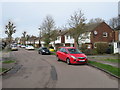
Monks Road, Enfield
Monks Road is a residential road in Enfield, in north London's outer suburbs.
Image: © Malc McDonald
Taken: 22 Feb 2020
0.11 miles
5
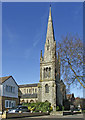
Christ Church, Chase Side, Enfield
One of the many attractive churches in Enfield.
Image: © Christine Matthews
Taken: 16 Mar 2007
0.12 miles
6
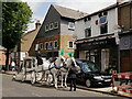
Final Journey
Collins Funerals. Hearse transport, old and new, at Chase Side, just north of Enfield.
Image: © Peter Trimming
Taken: 14 Jul 2021
0.13 miles
7
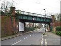
Bridge over Holtwhite's Hill, Enfield
A bridge carrying a railway line across Holtwhite's Hill, in the outer suburbs of north London.
The railway is the Hertford loop, a secondary line which leaves the East Coast Main Line at Alexandra Palace, rejoining it at Stevenage. The line is used mainly by suburban trains, but long-distance inter-city trains also use this line on occasions as an alternative to the main line.
Image: © Malc McDonald
Taken: 22 Feb 2020
0.13 miles
8
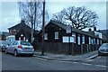
The Enfield Society buildings on Parsonage Lane
The look after the conservation in the area and arrange local events such as walks. https://enfieldsociety.org.uk/
Image: © David Howard
Taken: 28 Jan 2021
0.13 miles
9
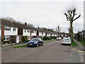
Monks Road, Enfield
Monks Road is a residential road in Enfield, in the outer suburbs of north London.
This image was taken in the month of February. Trees were bare for the winter season.
Image: © Malc McDonald
Taken: 22 Feb 2020
0.14 miles
10
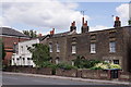
Enfield
Cottages located beside Chase Side.
Image: © Peter Trimming
Taken: 31 Jul 2018
0.14 miles