
IMAGES TAKEN NEAR TO
Park Nook Gardens, ENFIELD, EN2 0HT
Introduction
This page details the photographs taken nearby to Park Nook Gardens, EN2 0HT by members of the Geograph project.
The Geograph project started in 2005 with the aim of publishing, organising and preserving representative images for every square kilometre of Great Britain, Ireland and the Isle of Man.

There are currently over 7.5m images from over14,400 individuals and you can help contribute to the project by visiting https://www.geograph.org.uk
Image Map
Images are licensed for reuse under creativecommons.org/licenses/by-sa/2.0
Notes
- Clicking on the map will re-center to the selected point.
- The higher the marker number, the further away the image location is from the centre of the postcode.
Image Listing (106 Images Found)
Images are licensed for reuse under creativecommons.org/licenses/by-sa/2.0
Image
Details
Distance
1
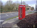
Phone box in Enfield
Corner of Clay Hill and Browning Road
Image: © David Howard
Taken: 11 Feb 2009
0.05 miles
2

The LOOP crosses the road
This section of the London Loop footpath doubles as a cycleway, hence this safety island at a road crossing.
Image: © Des Blenkinsopp
Taken: 5 Jun 2014
0.07 miles
3
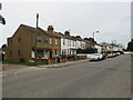
Clay Hill, near Enfield
A terrace of houses on Clay Hill near Enfield, in the outer suburbs of north London.
Image: © Malc McDonald
Taken: 22 Feb 2020
0.09 miles
4
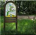
London Loop Information Board
You see these at intervals around the London Loop long distance path. This is by the entrance to a country park section.
Image: © Des Blenkinsopp
Taken: 5 Jun 2014
0.09 miles
5
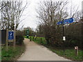
London LOOP and NCN12 near Enfield
A path shared by pedestrians and cyclists on the outer fringe of north London, near Enfield. The path is on the route of National Cycle Network route 12, and also forms part of the route of the London LOOP long distance footpath.
Image: © Malc McDonald
Taken: 22 Feb 2020
0.09 miles
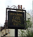
7
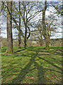
Hilly Fields Park, Phipps Hatch Lane, Enfield
Hilly Fields Park, Phipps Hatch Lane, looking towards Clay Hill.
Image: © Christine Matthews
Taken: 18 Mar 2007
0.10 miles
8
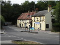
'Rose & Crown' public house on Clay Hill
The building dates back to 1700 and was once owned by the grandparents of Dick Turpin.
Image: © Robert Edwards
Taken: 29 Jul 2016
0.10 miles
9
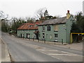
Rose & Crown, Clay Hill, near Enfield
The Rose & Crown pub on Clay Hill, on the outer fringe of north London near Enfield.
Image: © Malc McDonald
Taken: 22 Feb 2020
0.10 miles
10

The Rose & Crown, Clay Hill
The building dates back to 1700 and was once owned by the grandparents of Dick Turpin.
Image: © Mark Percy
Taken: 13 Jan 2022
0.11 miles