
IMAGES TAKEN NEAR TO
Monastery Gardens, ENFIELD, EN2 0AE
Introduction
This page details the photographs taken nearby to Monastery Gardens, EN2 0AE by members of the Geograph project.
The Geograph project started in 2005 with the aim of publishing, organising and preserving representative images for every square kilometre of Great Britain, Ireland and the Isle of Man.

There are currently over 7.5m images from over14,400 individuals and you can help contribute to the project by visiting https://www.geograph.org.uk
Image Map
Images are licensed for reuse under creativecommons.org/licenses/by-sa/2.0
Notes
- Clicking on the map will re-center to the selected point.
- The higher the marker number, the further away the image location is from the centre of the postcode.
Image Listing (110 Images Found)
Images are licensed for reuse under creativecommons.org/licenses/by-sa/2.0
Image
Details
Distance
1
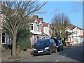
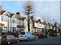
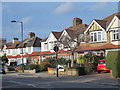
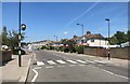
Monastery Gardens, EN2
Didn't see no monks. And I couldn't hear Ronnie Ronalde https://en.wikipedia.org/wiki/In_a_Monastery_Garden for the passing traffic in Image
Image: © Mike Quinn
Taken: 2 Dec 2015
0.03 miles
8
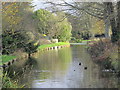
The New River (old course) south of Parsonage Lane, EN2
See Image
Image: © Mike Quinn
Taken: 2 Dec 2015
0.08 miles
9
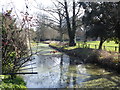
The New River in Enfield
The New River was completed between 1609 and its official opening on 29th September 1613. It was designed to bring clean water to London at a time when the heavily-polluted River Thames was the main source of drinking water. Sir Hugh Myddleton devised a 40 mile course that followed the contours of the land and only dropped about two inches every mile. It ran from springs near Ware in Hertfordshire to New River Head near the Angel, Islington but now finishes at Stoke Newington.
The New River remains an essential part of London’s water supply. The part to the south of Stoke Newington, where it survives, is more like a linear pond, but from Green Lanes upriver the water still flows as it has done for over 400 years. Much of it is followed by the New River Path. Ahead though, there is no path and the New River Path heads up to Parsonage Lane rather than following the waterside. This view looks upriver.
Image: © Marathon
Taken: 15 Mar 2017
0.08 miles
10
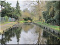
The New River (old course) by Chase Side Avenue, EN2
See Image
Image: © Mike Quinn
Taken: 2 Dec 2015
0.08 miles