IMAGES TAKEN NEAR TO
Severn Drive, ENFIELD, EN1 4LY
Introduction
This page details the photographs taken nearby to Severn Drive, EN1 4LY by members of the Geograph project.
The Geograph project started in 2005 with the aim of publishing, organising and preserving representative images for every square kilometre of Great Britain, Ireland and the Isle of Man.

There are currently over 7.5m images from over14,400 individuals and you can help contribute to the project by visiting https://www.geograph.org.uk
Image Map (Loading...)


Getting Data...Please wait
Leaflet Map data © OpenStreetMap
Images are licensed for reuse under creativecommons.org/licenses/by-sa/2.0
Notes
- Clicking on the map will re-center to the selected point.
- The higher the marker number, the further away the image location is from the centre of the postcode.
Image Listing (107 Images Found)
Images are licensed for reuse under creativecommons.org/licenses/by-sa/2.0
Image
Details
Distance
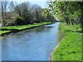
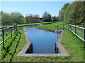
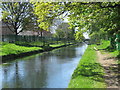
3
The New River north of Severn Drive, EN1
See Image
Image: © Mike Quinn
Taken: 4 May 2016
0.05 miles
4
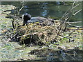
Coot's nest in the New River by Worcesters Avenue, EN1
See Image
Image: © Mike Quinn
Taken: 4 May 2016
0.06 miles
5
The New River south of Turkey Brook (5)
See Image
Image: © Mike Quinn
Taken: 4 May 2016
0.09 miles
6
The New River north of Hoe Lane
Image: © Mike Quinn
Taken: 4 May 2016
0.09 miles
7
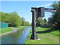
Hoist by the New River north of Hoe Lane (2)
See Image
Image: © Mike Quinn
Taken: 4 May 2016
0.09 miles
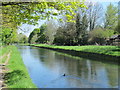
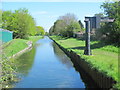
8
The New River by Worcesters Avenue, EN1 (3)
See Image
Image: © Mike Quinn
Taken: 4 May 2016
0.09 miles
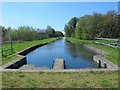
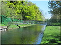
9
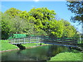
Footbridge over the New River by Worcesters Avenue, EN1
See Image
Image: © Mike Quinn
Taken: 4 May 2016
0.09 miles
10
The New River by Worcesters Avenue, EN1 (4)
See Image
Image: © Mike Quinn
Taken: 4 May 2016
0.09 miles