IMAGES TAKEN NEAR TO
Meadway, HODDESDON, EN11 8AP
Introduction
This page details the photographs taken nearby to Meadway, EN11 8AP by members of the Geograph project.
The Geograph project started in 2005 with the aim of publishing, organising and preserving representative images for every square kilometre of Great Britain, Ireland and the Isle of Man.

There are currently over 7.5m images from over14,400 individuals and you can help contribute to the project by visiting https://www.geograph.org.uk
Image Map
Images are licensed for reuse under creativecommons.org/licenses/by-sa/2.0
Notes
- Clicking on the map will re-center to the selected point.
- The higher the marker number, the further away the image location is from the centre of the postcode.
Image Listing (68 Images Found)
Images are licensed for reuse under creativecommons.org/licenses/by-sa/2.0
Image
Details
Distance
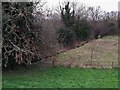
2
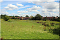
Wild Flower Meadow, Lee Valley Country Park
As seen from the New River Walk.
Image: © Christine Matthews
Taken: 1 Jul 2011
0.06 miles
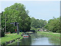
4
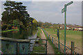
New River, Broxbourne
Despite appearances, this is not a canal but an artificial river first opened in 1613 to supply London with water; in fact, it could be argued that London could not have grown in the way it did without this impressive engineering feat. The river starts near Ware where it is fed by the River Lea and now continues as an open air water course as far south as Stoke Newington, although it originally continued to Clerkenwell. It is nowadays managed by Thames Water.
Image: © Stephen McKay
Taken: 28 Mar 2011
0.09 miles
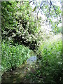
5
Spital Brook
The short Lea tributary emerges from under the New River.
Image: © Chris Brown
Taken: 31 Jan 2019
0.09 miles
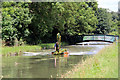
6
The New River north of Broxbourne station
See Image
Image: © Mike Quinn
Taken: 27 May 2015
0.10 miles
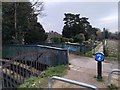
7
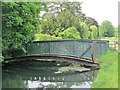
Footbridge over the New River north of Spital Brook
See Image
Image: © Mike Quinn
Taken: 27 May 2015
0.10 miles
8

The New River east of St. Catharine's Road, EN10 (2)
Image: © Mike Quinn
Taken: 27 May 2015
0.10 miles
9
Dredging the New River, Broxbourne, Hertfordshire
Image: © Christine Matthews
Taken: 1 Jul 2011
0.10 miles
10
New River: bridge to the St Catharine's estate
Image: © Chris Brown
Taken: 31 Jan 2019
0.10 miles