New River, Broxbourne
Introduction
The photograph on this page of New River, Broxbourne by Stephen McKay as part of the Geograph project.
The Geograph project started in 2005 with the aim of publishing, organising and preserving representative images for every square kilometre of Great Britain, Ireland and the Isle of Man.

There are currently over 7.5m images from over 14,400 individuals and you can help contribute to the project by visiting https://www.geograph.org.uk
New River, Broxbourne
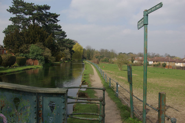
Image: © Stephen McKay Taken: 28 Mar 2011
Despite appearances, this is not a canal but an artificial river first opened in 1613 to supply London with water; in fact, it could be argued that London could not have grown in the way it did without this impressive engineering feat. The river starts near Ware where it is fed by the River Lea and now continues as an open air water course as far south as Stoke Newington, although it originally continued to Clerkenwell. It is nowadays managed by Thames Water.
Images are licensed for reuse under creativecommons.org/licenses/by-sa/2.0
Image Location
Latitude
51.751063
Longitude
-0.011093