
IMAGES TAKEN NEAR TO
Columbia Road, BROXBOURNE, EN10 6FR
Introduction
This page details the photographs taken nearby to Columbia Road, EN10 6FR by members of the Geograph project.
The Geograph project started in 2005 with the aim of publishing, organising and preserving representative images for every square kilometre of Great Britain, Ireland and the Isle of Man.

There are currently over 7.5m images from over14,400 individuals and you can help contribute to the project by visiting https://www.geograph.org.uk
Image Map
Images are licensed for reuse under creativecommons.org/licenses/by-sa/2.0
Notes
- Clicking on the map will re-center to the selected point.
- The higher the marker number, the further away the image location is from the centre of the postcode.
Image Listing (47 Images Found)
Images are licensed for reuse under creativecommons.org/licenses/by-sa/2.0
Image
Details
Distance
1
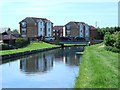
The New River north of Vancouver Road, EN10 (2)
Image: © Mike Quinn
Taken: 27 May 2015
0.10 miles
2
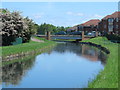
The New River south of Vancouver Road, EN10
See Image
Image: © Mike Quinn
Taken: 27 May 2015
0.11 miles
3
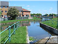
Slipway on the New River north of Turnford Pumping Station
See Image
Image: © Mike Quinn
Taken: 27 May 2015
0.12 miles
4
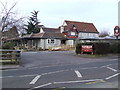
Bulls Head Pub, Turnford
Bulls Head Pub, High Road Turnford, which is currently a McMullens pub.
Image emerges from a culvert below the fence at the left of the picture.
Image: © Talisman
Taken: 24 Jan 2009
0.12 miles
5
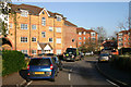
Yukon Road, Turnford
This new estate borders both sides of the New River on which large numbers of Canada geese are to be seen. This may explain why all the roads are named after places in Canada.
Image: © David Kemp
Taken: 23 Dec 2015
0.12 miles
6
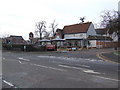
Bulls Head Pub, Turnford
View of the Bulls Head Pub, High Road Turnford from Image which was previously the "Old Bulls Head".
The Bulls Head sign states "since 1525"
Image: © Talisman
Taken: 24 Jan 2009
0.13 miles
7
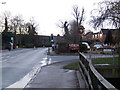
High Road Turnford
Looking south along High Road Turnford by the sign for the Bulls Head Pub (which is just off to the right).
Turnford Brook is in the bottom right corner, where it goes under Rochford Close and the Bulls Head Car Park.
Image: © Talisman
Taken: 18 Jan 2009
0.13 miles
8
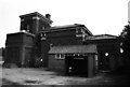
Turnford Pumping Station
One of several New River pumping stations. This one is home to a Boulton, Watt & Co side lever engine. Unique - no other word for it!
Image: © Chris Allen
Taken: 28 Aug 1981
0.13 miles
9
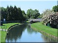
The New River south of Vancouver Road, EN10
See Image
Image: © Mike Quinn
Taken: 27 May 2015
0.13 miles
10
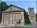
Turnford Pumping Station
Image: © Mike Quinn
Taken: 27 May 2015
0.13 miles