
IMAGES TAKEN NEAR TO
WEST CALDER, EH55 8HH
Introduction
This page details the photographs taken nearby to EH55 8HH by members of the Geograph project.
The Geograph project started in 2005 with the aim of publishing, organising and preserving representative images for every square kilometre of Great Britain, Ireland and the Isle of Man.

There are currently over 7.5m images from over14,400 individuals and you can help contribute to the project by visiting https://www.geograph.org.uk
Image Map
Images are licensed for reuse under creativecommons.org/licenses/by-sa/2.0
Notes
- Clicking on the map will re-center to the selected point.
- The higher the marker number, the further away the image location is from the centre of the postcode.
Image Listing (18 Images Found)
Images are licensed for reuse under creativecommons.org/licenses/by-sa/2.0
Image
Details
Distance
1

Swans on Old Shale Mine Reservoir near Addiewell
At one stage in the late 1800s it is reckoned that West Lothian produced 2% of the world's oil, and the Addiewell Chemical Works, once situated NorthWest of these reservoirs, was one of the largest operations in the area. Apparently the floodwater from some of the shafts was pumped into this specially created reservoir, allowing a ready supply of water to steam-power the mining operations. A fairly well-trodden footpath runs alongside this pond, and a much smaller one to the West. Easiest access is from a high open area of grassland to the North, just off the West Calder to Blackburn road.
Image: © Ian Dodds
Taken: 23 Sep 2020
0.10 miles
2
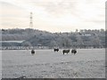
Tups, Addiewell.
A field between the A71 and A704. Looking south towards mine waste. The tups wandered over in case of a handout. My shepherding days are past now, so they were disappointed. All had bloody heads as a result of fighting. Although hormonal changes strengthen their skulls in the autumn, they still often manage to inflict fatal injuries on their opponents.
Image: © Richard Webb
Taken: 29 Dec 2005
0.11 miles
3
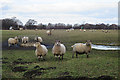
Neighbourhood Watch
I am clearly under intense scrutiny by these sheep as I take their photograph from outside the field. Beyond the field is the A71 road to Lanark, and in the background is the angular shape of the Five Sisters bing.
Image: © Anne Burgess
Taken: 20 Feb 2018
0.13 miles
4
Trees at Road Junction at Dusk
This was taken from one end of the very short A704, looking across the A71. While it is an old road, the A704 is now essentially used as a shortcut to get between the A71 and the A706 which heads to Lanark. It must be, per mile driven, by far one of the most dangerous roads in the area as it is fairly quiet but regularly closed due to accidents - the sharp bends and double-bends often catching drivers out.
Image: © Ian Dodds
Taken: 31 Dec 2020
0.14 miles
5

A704 near junction with A71
Gateposts on left show where mineral line previously crossed road.
Image: © Jim Smillie
Taken: 15 Oct 2010
0.14 miles

7

Railway Bridge over Old Long Disused Road
This bridge is southeast of the once enormous Addiewell Chemical Works, and the road ran from the main road - now A71 - to the modern day B792 (West Calder to Blackburn road) before and during the oilworks operations. Is still shown as a path on mid 20th century maps.
Image: © Ian Dodds
Taken: 23 Sep 2020
0.15 miles
8

View from a train - pond near Addiewell
Image: © Nigel Thompson
Taken: 8 Jun 2019
0.16 miles
9

Old level crossing remains at Addiewell
All that remains of a level crossing on the A704. The line would have been one of many criss-crossing this old mining area in the 1940s-50s. I had not passed this way for many years, but I recall that 30-40 years ago the gates were still there.
Image: © M J Richardson
Taken: 15 May 2015
0.18 miles
10

HMP Addiewell from the air
Seen on approach to Edinburgh from the west.
Image: © Thomas Nugent
Taken: 7 Feb 2020
0.18 miles