
IMAGES TAKEN NEAR TO
Bishops Park, LIVINGSTON, EH53 0SS
Introduction
This page details the photographs taken nearby to Bishops Park, EH53 0SS by members of the Geograph project.
The Geograph project started in 2005 with the aim of publishing, organising and preserving representative images for every square kilometre of Great Britain, Ireland and the Isle of Man.

There are currently over 7.5m images from over14,400 individuals and you can help contribute to the project by visiting https://www.geograph.org.uk
Image Map
Images are licensed for reuse under creativecommons.org/licenses/by-sa/2.0
Notes
- Clicking on the map will re-center to the selected point.
- The higher the marker number, the further away the image location is from the centre of the postcode.
Image Listing (13 Images Found)
Images are licensed for reuse under creativecommons.org/licenses/by-sa/2.0
Image
Details
Distance
1

Waymark
At this point a path leaves the route above the left bank of Murieston Water and descends to a footbridge giving access to Calderwood.
Image: © Anne Burgess
Taken: 14 Apr 2016
0.12 miles
2
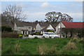
Spottiswoode Gardens
Spottiswoode Gardens consists of a main drive and several spurs, all of them culs-de-sac. The path along the bank above the Murieston Water passes along to the south, and this is looking north from that path.
Image: © Anne Burgess
Taken: 14 Apr 2016
0.13 miles
3
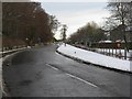
Main Street, Mid Calder
Now a quiet unclassified road through modern housing, this was once the A71 main road from Edinburgh westwards to Kilmarnock.
Image: © M J Richardson
Taken: 20 Dec 2009
0.13 miles
4

Murieston Water approaching Mid Calder
I always find it much more enjoyable to walk upstream than down. I have decided this is all to do with the relative speed of the water - it appears to run faster than it really is when walking up the way but slower than it really is when walking down.
A very muddy path follows the course of the water on this Eastern side with other occasional paths branching off up a very steep slope to Calder Wood.
Image: © Ian Dodds
Taken: 30 Mar 2021
0.14 miles
5
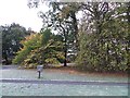
Woodland, Caroline Gardens
Some woodland which has survived the building of Livingston.
Image: © Richard Webb
Taken: 5 Nov 2013
0.16 miles
6

Ruined bridge, Murieston Water
Buttresses of a bridge over the Murieston Water, Calder Wood. The OS map still shows a bridge here. The bridge was intact in 1987 as it is shown on the previous edition of the Calder Wood orienteering map.
Image: © Richard Webb
Taken: 28 Jan 2007
0.19 miles
7

Midcalder Primary School
Some way out of the old village, but handy for the extensive new housing development that has occurred over the last 20 years.
Image: © M J Richardson
Taken: 11 Sep 2010
0.20 miles
8
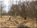
Orienteering, Calder Wood
Taken when returning from a stint doing pre race security - i.e. just making sure no one walks off with the control flags and timers. My job was done when the competitors turned up.
Image: © Richard Webb
Taken: 28 Jan 2007
0.22 miles
9

Crumbling Bridge Uprights on Murieston Water
Not exactly sure when this bridge came down, but it must have been relatively recently. Richard Webb has a picture of the same ruined bridge uploaded here from 2007, and also mentions it is still shown as present on a 1980s map. It is also, rather strangely, still present on the initial map that appears alongside this grid-square on this site!
It was around a while - it is first shown on an 1853 OS map. A track used to head South from the South Lodge of Calder House to the bridge. The track then split, but both branches don't seem to end up anywhere in particular on the old maps. South Lodge is still standing and now sits at the entrance to South Lodge Avenue, a fairly upmarket residential street in Mid Calder.
Image: © Ian Dodds
Taken: 30 Mar 2021
0.23 miles
10
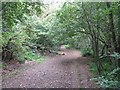
Ancient track in Calder Woods
Leading down to the bridge over the Murieston Water Image The stone bridge, unfortunately, is no longer there, but replaced by an unattractive but modern and functional bridge.
Image: © M J Richardson
Taken: 11 Sep 2010
0.23 miles